Day 1
The May long weekend canoe trip (May 20 in Canada), was a trip I'd been looking forward to for some time. A three day weekend with some old friends from high school days I do not see enough of. The trip is a a run from Nordeg down to Rocky Mountain House. Three days on the North Saskatchewan river.
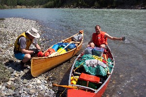
We'd hoped to be at the put in Friday night, camp over and be on the river early. Instead all of us were late getting to our meeting place, prior to driving out to the setin. We stayed at Jason's house, in Rockey mountain, and headed out the next morning. It was about 1:00 by the time we had the canoes packed up and on the river.
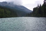
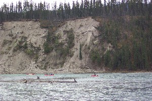
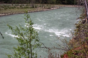
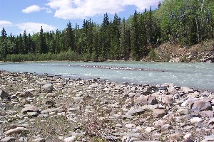
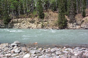
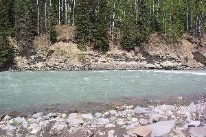
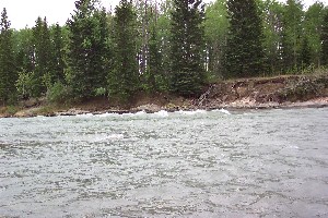
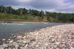
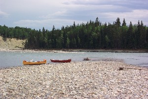
The set in is at the bridge over the N. Sask river. To get there driver a few km past the exit to Nordeg on Hwy 11 (going west). Turn south and drive down Hwy 40 (or 734?), a dirt road, This is the first major road after the turnoff into Nordeg. Follow this road until you get to the bridge. The set in puts us just at the point where the mountains are transitioning from covered in trees to big barren snow capped rocks. The river has some speed to it, but not much, running around 8km an hour. It is tinged with the blue colour associated with the silt from the rocky mountains. The water is cold, coming from the snow capped mountains and all.
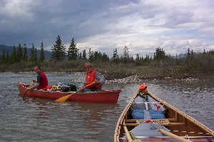
We do not have any big blue barrels or large packs. I've several small dry bags used for sea kayaking. It takes some time to get all our gear packed for the canoes. Chris and Randy go with the plastic bag water proofing method, and decline the extra dry bags I have. They are in the water waiting for me to get the canoe loaded. I'm in a rush, and do not do a good job packing the canoe.
Today the weather is calling 60% chance of rain. Looking at the clouds, it is obvious will be rained on today. Furthermore it is a bit windy. It is soon very obvious that my packing job is no where near good enough. My Bow is to high in the air, and spinning me around like crazy. Chris and Randy are way out of hearing range. I pull over and spend another 20 minutes re-packing my canoe. Waving to all the canoes from the university group going by. Time well taken. It's still a bit of work fighting the wind, but now it is possible.
I finally catch up to Chris and Randy, who figured out I was stopped and waited, just around a corner. Their two paddles, are making much better headway than me so they are out a head most often. It's overcast but still a very nice day to be out. The river is surrounded by mostly pine trees, with the odd poplar and other deciduous tree. As we leave the campsite, we also start to leave the whine of the ATVs that were playing around near the site.
Chris is now taking a nap in the front of the canoe. He's figured out that I'm not keeping up, or he is just getting bored with paddling. I'm still having a bit of trouble with the wind. I see Randy taking a small channel to the right. There are a few sweepers out over the water, but no strainers. I'm about to say something in the way of a warning (Randy is not an experienced river canoeist), when I'm hit by a gust of wind and a light eddie line and spin around 180 degrees. As I'm coming around strait, I hear an "Oh #&^$&". Randy and Chris are now swimming.
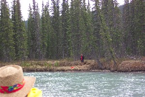
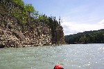
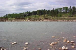
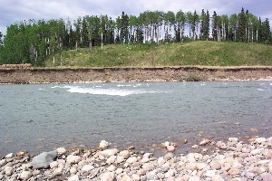
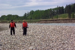
I make it to the end of the small island, toss Randy a throw line, and pull him into to shore. Chris went after his paddle, and ended up on the other shore. You can see the sweeper in the second picture the farthest one off in the distance. We regroup, and continue on Chris and Randy deciding they are warm enough to keep going without changing. Kind of gun ho these guys are.
We continued on towards the gap. The gap being the last pair of mountains that the river runs through. We pass the university group that had stopped for lunch. After a bit Chris and Randy decided that maybe being warm is worth a 15 minute stop to put on some dry cloths. We are once again passed by the University group, it is a fairly large group from Edmonton. We play a bit of leap frog with this group for the first two days. Other than that we only see one other canoe on the water, and pass one other group.. I'm surprised, I expected more people to be on the river this weekend. I know of at least two other groups out but they left earlier enough that we do not see them.
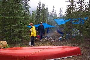
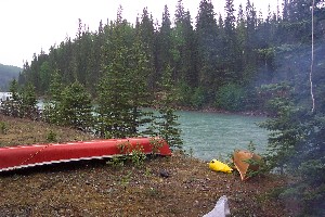
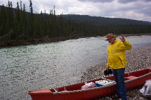
We pull in to camp in a light rain. We setup on an island 14km above Saunders Ledge. It is still fairly early, but good the extra time helps to dry out some gear, including Chris' sleeping bag. After some supper, we wander about the island a bit. The East end of the island has a really nice campsite right at the point. At the West end we are checking out the rapids that are indicated as class one. There are some rocks in it, but very little water. I'm describing different wave types to the guys (stoppers, holes, keepers...) as we work our way to the point of the island.
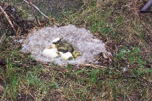
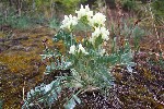
Suddenly there is a flurry of honking and flapping. A goose had been stealthily sitting on her nest, we did not see her at all. Inside the nest is a very young family of geese. The oldest one is still covered in Egg goo. The youngest ones still in the egg, and at least one still working it's way out of the eggs. We stopped long enough to take a quick picture and start heading back towards mom. Figuring that her honking and not leaving the area is her way of drawing us off. That way she can get some satisfaction out of leading us from the nest. As we approach she takes to the air, and circles back to her nest.
Day 2
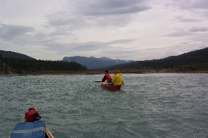
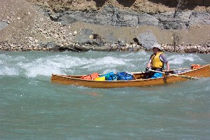
It looks like day two (Sunday) is going to be a nice sunny day. So far the river has been very easy going. Running fast, but smooth. We come to our first set of waves, this is above Saunders, perhaps it was "pipeline", perhaps not. We stop to take a look, and of course decide to run through it. The waves are small, but still enough that Chris needs to bail out the canoe. Not long after we come to the first real set of rapids on the river. Upper Saunders.
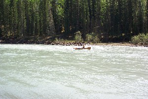 Myrl hitting first bit of small waves.
|
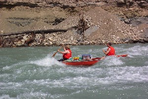
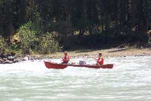 Randy and Chris in the same first set of small waves.
|
 Chris bailing out after the first set of waves.
|
Randy and I, climb up through the woods to take a look. Upper Saunders is on River right, and is basically a wave set. The wave size is such that I do not want to run it having never been down this part of the river. I'm not really experienced with running rapids, and decide I'll just skirt the set. Chris and Randy run it after I do, and go a bit more aggressively. Just as they are going through, there is the whine of engines coming up river. I'm on shore and make sure the boats see The canoe just entering the rapids. The give a wave and proceed going up river, hitting Chris and randy with the wake just as they are in the rapids. They make it through fine, but more bailing is required.
About 500m after Upper Saunder's comes Lower Saunders. It starts off as a wave set, but near the end is a nearly river wide ledge thing. I pretty much skirted the whole rapid. Chris and Randy were going to do the same (at least Randy was). But ended up running the first part of the rapid. Some furious paddling with a canoe 2/3 full of water allowed them to miss the big long wave at the end, but only just. Some more bailing required... you'd think they'd have a bigger bailer. ;-)
 Lower Saunders, pic 1
|
 Lower Saunders, pic 2
|
 Lower Saunders, pic 3
|
 Lower Saunders, pic 4
|
 Lower Saunders, pic 5
|
 Lower Saunders, close up of big wave
|
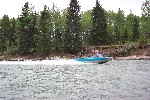
After Saunders it was a pretty easy going paddle down to hornburg for the camp that night. There is road access to Saunders campsite, and the ATVs were back, around this area. We had stopped early the night before, and needed to be at Hornburg to meet up with another friend, Jason, who was joining us for the last bit of the trip on Day three. As we were pulling into the takeout, there was a vaguely familiar figure out on the coindyke at the take out. It was Bernie, one of the guys in a canoe building course I was part of over the winter. It was good to see him, I knew he'd be on the river, but he started a full day ahead of us, so I was surprised to actually meet up.
Lots of mosquitoes at this camp site. Horburg campsite is an official campsite, and there is a $13 fee to use a site. The sites on the up river side look to be the nicest. They are a bit removed from the parking lot, and are tent only. The $13 gets you firewood, and an outhouse.
Day 3
Today is the final day of the run, from Hornburg to Rocky Mountain House. I've run this section before, and know there are some honest rapids in this part of the trip. We were slow getting going, Jason showed up about 10:30, and we still had the tents up. I'm sure it was pushing 12:00 by the time we were on the river. So we were pressed for time now, as I still had to get my car at the put in, load the canoe and drive back to Cowtown afterwards.
Today I'd be paired up with Randy in my canoe. Jason and Chris were really keen to run the rapids. Randy and I were keen to stay dry, although today I did put on my wet suit just in case I felt the urge to swim. At the onset I'm nervous. The canoe feels twitchy with other people in it. By the time we get to Devils Elbow, I've decided I'm not to keen to try and run it. Randy is a very calm under pressure kind of guy, exactly what you want in a canoing partner. But still, not very experienced with running rapids.
We stop just above devils Elbow to get a picture of Jason and Chris running a couple of waves just above the main rapid. Thinking they'd stop and take a look at the Devi's Elbow rapid. Instead they holler that they are running right through it. Jay is very familiar with the river. To bad I'd have liked to look, and get a few pictures. Randy and I jump back into the canoe and catch up to Jay and Chris. They are running the outside line, right with the big waves. As we get close to the rapids, I become confident we'd either swamp (no cover), or tip. Randy expresses that the rapids look like to much, and I agree. Without scouting, we decide to take the inside corner.
Randy and I come down just inside the waves, enough for a fun ride, but also enough that we have a hope of getting out if we start taking to much water. It seems that there is a point about 1/2 through the rapids, where the current line on the right side really starts to push into the rapids. We paddle our way through, and do a bit of an eddie turn into shore. By the time we stop, and look over Chris and Jay have the underside of the canoe facing up, and are swimming.
I grab the throw rope and start running down stream. A bit of a trick on the melon sized rocks, with ankles I can not feel from kneeling. I catch up after 30m or so. However Jason waves of the throw, saying they will flush to shore just after the rapids. So back I go, get in the canoe and paddle down. The other canoe did not make it into the eddie after the rapids, but did come to shore just down stream. After helping emptying it, giving Chris my dry socks and shoes we continue on. It turns out that while in the rapids, the bailer rope had wrapped around Chris' leg, and he had to yank off his sandal to get his foot out. Yikes.
Unfortunately I did not get any pictures of the Devil's Elbow, and by the time we helped get Chris and Jay, and their canoe back up right, we kept on going down stream.
There are several Rapids running down from Hornburg to Rockey, After the Devils Elbow is Mothers, Gray's, Fishers, Greer, lower fishers, and the Brierleys, and that is not mentioning several sets of 'riffels'. xxxxxxxxxxxxxxx
We pull in to camp in a light rain. We setup on an island 14km above Saunders Ledge. It is still fairly early, but good the extra time helps to dry out some gear, including Chris' sleeping bag. After some supper, we wander about the island a bit. The East end of the island has a really nice campsite right at the point. At the West end we are checking out the rapids that are indicated as class one. There are some rocks in it, but very little water. I'm describing different wave types to the guys (stoppers, holes, keepers...) as we work our way to the point of the island.
I have no recollection of Mothers, needless to say we avoided a swim. Gray's, a rapid that has flipped Chris and myself in the past, we missed this time. The thing is, The channel that ran into it seems to be some what starved out. Perhaps the water was low today, or we did not see the rapid from the channel we were in, however it seems like Grey's rapid is 'gone'.. There is a wave train after it that would have been pretty exciting, had we run through it dead on.
Later, while Chris and Jay were running through one wave train, one that looked to be an easy set of fair sized waves, nothing they had not run through before, they managed to tip. They quickly got to shore, and Randy and I chased down a water bottle, and one bag of something that was not tied down. At this point, I did manage to get a bit of a scare. We were cutting into shore to wait for The other guys to get back on the river. The shore had a (stubby) strainer down stream, the current was pretty minor. A quick and easy landing 30m above was all that was required. Here, maybe I'd become too comfortable with Randy, and the decision land on the outside of the corner was suspect. Anyways, coming in he made the wrong stroke, which through our turn to get the Stern pointed upstream. Fine, I told him to do a draw. He hesitated, and I barked at him to draw and he did. Then a forward stroke and we were at shore, but only about 10 ft above the strainer. This is a move that me and my normal partner would not even discuss. Somewhere in my mind I assume Randy would know exactly what to do. Funny, I've been going solo for most trips this year... working with a new partner is a bit stressful for me, and the communication thing... shesh..
The next Rapid of note is Fishers, and Fisher's is one rapid that gives me pause. It is only rated class II on the canoe map. (compared to II+ for Lower Saunders, and Devil's Elbow). the reason it gives me pause, is that you runs a set of waves, including one large wide wave, then need to cross the river before hitting the second set. The second set of waves seems a bit pushy, and has a sharp corner with and undercut outcrop of rock. This is the one rapid that a (knowledgeable) novice may have trouble avoiding. We ran it timidly, keeping out of the way of the current.. I only have pictures of the upper portion of fishers, not the lower portion around the bend.
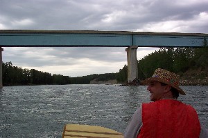
We were (at least I was) getting a bit warn out at this point. We started rafting up and floating for the easy sections and breaking off when waves showed up. One section of waves is just above the blue bridge in the picture. This is the only bridge other than the one at the set in that we cross under.
The next Rapid is the Brierleys, and is not to far below the blue bridge. The entrance to this set of waves did not look open canoe friendly. It was a combination of two standing waves. One the normal wave perpendicular to the flow of the river, the other a wave reflecting off the bank. This combined to one ugly looking wave (for a canoe). Then several large waves running in tight to the outside corner of the bank. Complete with one tree that was hanging down in the river (but not out into the water). We avoided this water. I'd setup a back ferry to slip in to the inside of the corner and miss the rapids. A move that Randy was not familiar with. I think he was mildly surprised when we did not get swept into the big waves. But then the Back ferry is always a bit spooky from the bow, as you are getting closer to the hazard. The Briarley's are easily avoided by taking the left channel.
After that it was an easy float down to the take out at Jay's dad's homestead. I'll definitely want to be running that day from Hornburg over again, taking a weekend to practice canoing in the waves.