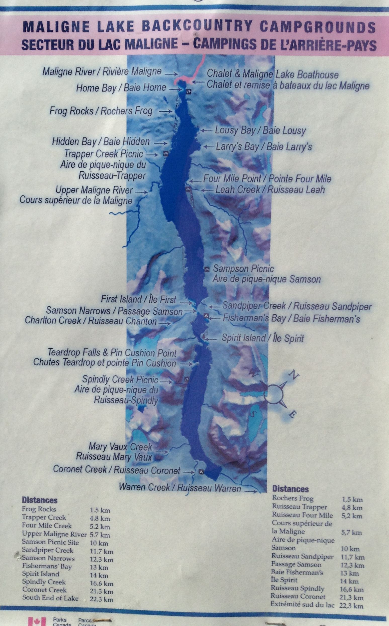
Trail Description:
Day 1
We'd previously driven to and stayed at whistlers camp ground, so that we could get an early start at the lake. This is a "full amenities" campsite.
That is it has showers, lots of camping stalls, a few interpretive like spots, not really my cup of tea. I'm sure we did end up on the lake a couple hours earlier than we otherwise would have if we'd driven from Calgary, so mission accomplished. The drive up the Columbia icefield is more than slightly stunning by the way.
On the drive up the winding road to Maligne lake itself, past Medicine lake we see black bear on the road which is fairly special, or so I think.
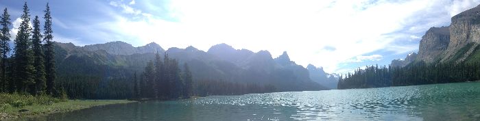
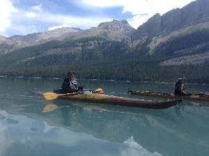
Put in is at a bona fide boat launch, no lugging down a steep bank, or anything like that. There is a group of three young ladies climbing out of a canoe just finishing their trip. They said it was spectacular, which bodes well for us.
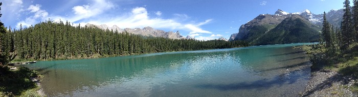
Home Bay Panorama - from the Put-in
The lake is long and fairly narrow, once out of home bay it opens up a bit and you can more or less see what seems to be the length of the lake. Unfortunately I had my camera stowed and got not pictures of the first part of the paddle.
The first day is a paddle out to fisherman's bay. With the slowly changing and very nice scenery of the first half of the trip. There are some really big rocks (Frog Rocks) in places on the edge of the shore. There is what looks like a small controlled burn area from years gone by. The mountains are not a rugged as some places, and do not loom over the lake on the East side. Still very nice area to paddle out through. Sadly my camera did not get used on this section of the trip, as it was packed away in my hold.
We do make one stop on the way out, I believe at Leah creek.
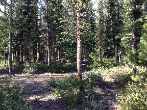
Fisherman's bay campsite
It turns out what appears to be the end of the lake is in fact just Sampson's narrows. It is just past this narrowing, on the East shore that Fisherman's Bay is located. This is our first nights camp spot. Distance traveled on the first
day is 13km.
It is worth mentioning that on this first day of the trip the are tour boat's running up and down the lake to Spirit Island, which is just past Fisherman's Bay. So you get their wakes (an other boats wakes) for this part of the trip. This is not the case past Spirit Island, after that it is manual (perhaps sail) powered crafts only (yay).
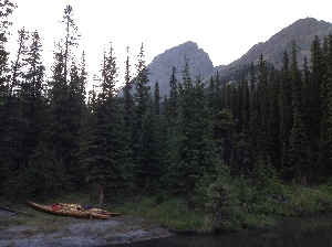
The Three kayaks at Fisthermans bay.
The views have been good, But Ross promises the next day will be better.
As we setup camp, we get confirmation that there are fish in the lake, as one of the other groups we are sharing the camp with offer us a fish, they had quite the tarp setup. The other
group in the site is 5 or 6 inexperienced campers, which go about cutting down living tress to start a fire. Folks, please please don't be that kind of jackass, this is a national park, and this campsite is well used. It does not
take much of this type of abuse before it is ruined.
Day two:
Well Day 2 proved Ross was right, the views were stunning. With breakfast out of the way, and an early breaking of camp, we were onto the water early enough that the water was like Glass. Morning is usually the best time to avoid the wind, and the wind can really come up on any mountain lake, including this one. But not today.
We only have 10km today, and lots of time, so we don't press ourselves. Perhaps because we are a bit tired from the day before.
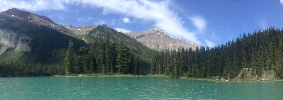
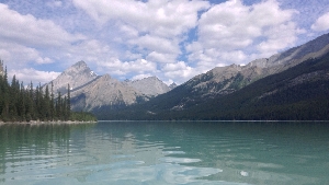
Spirit Island panorama. Taken just after the Narrows
A fairly short distance from Fisherman's Bay the lake narrows again, and you come around the bend to Spirit Island. There are lots and lots of great
pictures of this Island, probably one of the most photographed spots on the in the park. Interestingly it is not actually an island, as you could walk to it from shore. This is where all the tour boats are going, there is a dock
further down the shore, and a walk way that runs up from it to above the island.
Spirit Island from the South Side
After this we have the rest of the lake to ourselves, only one other boat, which was fishing just past spirit island. Ross was right there is some pretty spectacular scenery here.
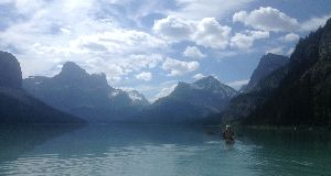
Edel heading South, into the nicest part of Maligne lake.
Ross, beautifle lake, mountains and no wind.
Ross and Adel gliding past.
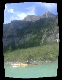
Vew looking back North, about 1/2 way or so between Fishernam's Bay and Coronet Cr.
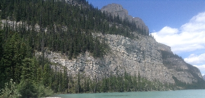
shore line.
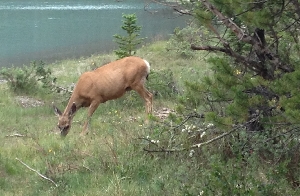
We arrive fairly early at Coronet Creek camp site. There is a pier, and we have it and the site to ourselves. There are lockers here for food, a dozen or so campsites, and a common area with tables. The only company we have at first is a pair of deer which wander through, more or less ignoring us.
After camp is setup, and supper is done, we are joined by a squirrel as we are cleaning up. He is quick to get on our table and get a scrap or two, before it is cleaned up.
[pic 20]
Quiet Neighbour
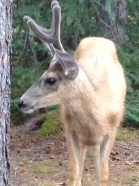
Young Buck
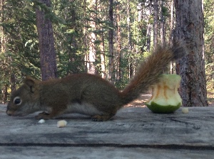
Our not so quiet neighbour
Later a young couple that work at the Chalet at the other end of the lake join us. A fellow kayaker does show up, and we chit chat for a bit, then he paddles back to the other end of the lake... a fairly impressive 46km day on his part.
Day 3 hike Coronet Creek trail We've booked the site for two days. My paddling partners are content to relax around the campsite. I'm going for a hike, and am in luck as the two other
campers, Dave and Nancy(?) are heading out on a hike and are happy to have me along. see the Coronet Creek hike
Day 4: originally we'd planned to paddle back to fisherman's bay and stay the night, breaking up the trip. However again today there is little in the way of a head wind. I'm not to keen to setup camp only to tear it down and head out in the morning, so decide to paddle on. Ross and Adel also choose to make it a one day trip, followed by the dive home.
|