Trail Description:
The drive in had a disturbing lack of snow. The views from the road driving out from Calgary are brown, and only look slightly better as we make the turn down on HWY 40 to Kananaskis. It is only in the last few km of the drive that it becomes apparent that there is going to be enough snow. In fact the snow turns out to be very nice. The other concern is the wind, it is really gusting during the drive, once at the ski area it is beautifully calm in amongst the trees. With fresh snow gently falling down throughout the trip.
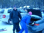
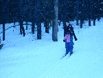
Someone is happy to be out
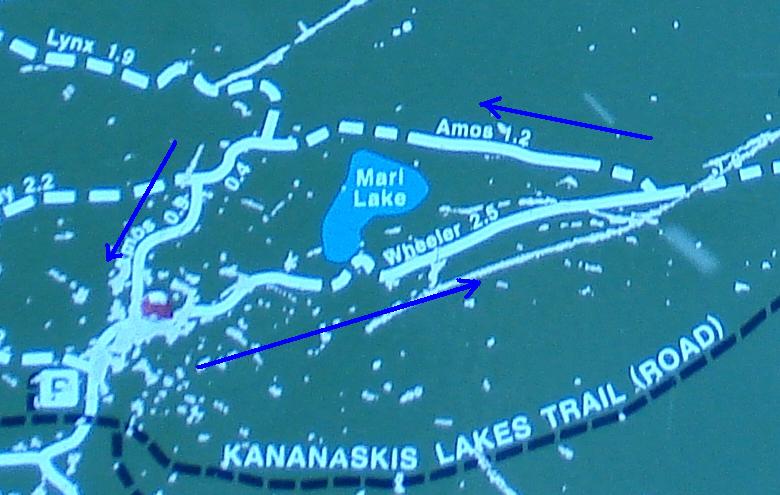
The sign age is present at all junctions, the signs are a bit old, you can see where people are pointing with the bottoms of the ski poles, and have chipped the signs up a bit. However they are still readable, and fit for use. You can see from the picture of the sign that there is a fairly good system of trials here. The sign indicates the easy/medium/and hard with the line types of solid/square dashes/round dashes respectively.
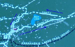
Close up of map
We did a very small portion of the trail shown on the sign, sticking to “Wheeler”, and Amos. This being one of the easiest runs in the area.
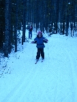
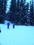
The tracks appear to be groomed here, but I'm not experienced enough to know for sure. The trails seem to be exclusively used by cross country skiers based on the day I was out. The run we go on is double tracked. There are lots of people out today.
Having been in the area before, I know there are some good views to be had. Today the weather brings low cloud, and snow. No spectacular views are to be had, yet it is still good to be out.
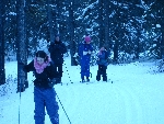
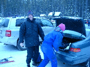
There are four of us in our group today, James, Deb, Rachel and Sarah. Rachel is the youngest at 8yrs old, and Sarah at 14yrs. Both new to cross country skiing. Apparently this is the first real ski trail they will have been going on. Sarah seems to have no problem at all, Rachel starts of the day requiring some coaching from deb.
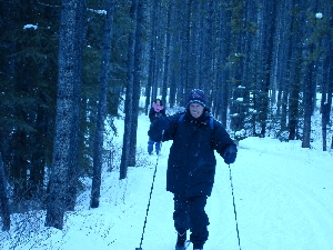
James showing his girls how it's done

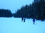
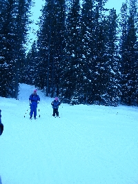
Rachel and Sarah comin' down the tracks
There is a considerable group of trails here. The staging area is the parking lot of a campsite, which is closed for the winter. We are running down wheeler first, it is a bit of an easy down hill from the parking lot towards the South-West. The trail runs in to Marl lake, and comes right back out, giving a brief glimpse of what looks like a small pond. According to the map it is a small bay of a small lake. Although that does not match my memory. There is a bit of an uphill section here, where we debate the 'chicken walk' climb, vs the parallel ski climb for the girls.
A little further on you come to what should be a good view, to the west, however the low laying clouds and snow have blocked it in today. There is a couple of picnic tables spaced out along the 1.3km that over look a swampy area a few hundred feet below the trail. We stop for lunch at one. Rachel the 8yrs old, gets on her skies and takes off, now looking like a pro. The problems she was having at the start are completely gone, at least on the flat sections.
At the junction to Amos, we turn a hard left and head back, this is approximately 2.7 km from the trail start. Up until now the trail has been an easy run, with a couple minor incline and decline, but more or less flat. As you turn on Amos, there is a low slope uphill run for a bit, still easy. However Amos does come with a few small uphill and down hill sections that are rated intermediate on the trail maps. These consist of fairly short down and uphill sections as the trail runs in to and out of low laying swamp/creek areas.
Coming down the hill
On the downhills and up hills Rachel had a bit of trouble, but not to much. There is one longer section where she was wiped out, in front of a group of 4 or 5 people coming the other way. While trying to get her back on her feet, several people passed going down hill. To into their workout to let a child get up, one even offering such useful advice of “better get that kid off the hill”. What a Jackass. Other than him, everyone else we met on the trail was very pleasant.
Most of the trip is in the trees. We do come out on a lake or grassy area, and get treated to a nice open area. The nearest slops of the mountains are ghost like in the fog and snow.
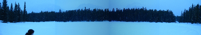
Panorama of an openting
The trail comes back in through the camping sites. Past the interpretive center (I assume that is what it is), and back to the parking lot. It took about a couple hours for our group to run the 5-6km of the trip. Not bad, considering some of us are new at this, and we stopped for lunch.
One telling thing was both Rachel, and Sarah ( a self professed mall rat, who hates Gym class), both wanted to come out and do it again next weekend. That has to be the definition of a successful ski trip. I certainly enjoyed my first outing of the season.
|