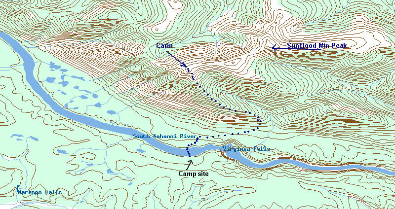
The Trip Report: It is a bit of a trick getting to Sunblood mountain. It is a short ˝ day hike on the Nahanni river trip in the North West Territories of Canada. Even so, there is a well warn trail up to the ridge of Sunblood Mtn. The hike is highlighted in the “Nahanni river guide -3rd Ed”, by N. Harting, and P. Jowett.
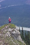
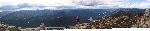
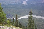
Looking across the river to part of Sunblood Mtn.
The Hike starts just across the Nahanni river from the Nahanni river campsite / warden station. So to get there you need to cross the river. No problem, if you are here, you probably have a canoe.
After getting dropped of to start our 10 day canoe trip, we’d allocated a day to stay here, and get ourselves sorted out. Day 2 was the hike up Sunblood. We’d watched a couple planes come in and take tourists off to inspect Virginia Falls. A young lady, “Lizzy” was out taking survey of their experiences of the trip. She’d been out for some time at it, and had watch several groups cross the river to hike the mountain. As it would happen we were an odd numbered group, and had room in the Bow of our canoe. After the invite, she was happy to join us.
Crossing the water is easy, it is like glass, with very little current. However knowing that just down stream several hundred meters is Virginia Falls. Which would be sure death if you went over, makes the paddle over slightly worrying , especially with a new paddling partner in the front. Some day I’m going to learn how to swim better.
The hike starts right at the river, and goes through a bit of somewhat swampy ground. Surrounded by the pine trees. The trail leads strait to the Mtn, and starts to climb.
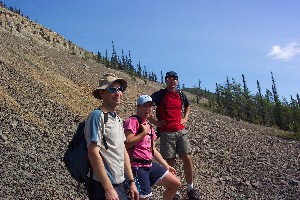
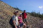
The gang waiting for me at the scree slope
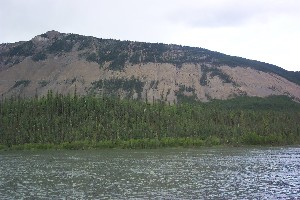
Turning to the right, it then begins to cut upwards at an angle to the ridge line. You come out of the trees along a scree slope. From here you get your first views back to the river, right back to Virginia falls in fact. The trail is just the way I like it, Obvious, but not one of the over trodden trails of somewhere like Banff.
I’m already getting tired, The other three are definitely faster than I. I like to plod along, where as they are quickly pulling away. That is fine, another good reminder that I really should get back into better shape. After the scree slope the trail again enters the forest, and some comes to the ridge of the mountain. From here it pseudo traverses up along the edge, to the right is a valley running down from the peak. A combination of Rocks and trees. To the left somewhere is the Nahanni.
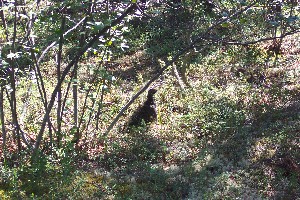
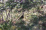
A wild grouse.
We come upon what would probably be the largest critter we see of the trip, maybe the rabbits were bigger, hard to say, they seemed really small. This grouse of some kind did not seem at all afraid of us, barely acknowledging us as he calmly walked away.

Giant Steps, where only Mtn Goats dare tread.
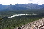
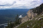
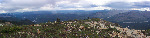
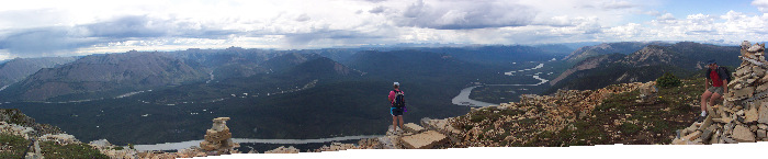
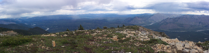
The trail comes back closer to the Nahanni river, and the trees open up a bit. Giving a nice view down the valley the Nahanni winds through. As well a view out into the valleys through which Marengo creek runs. Still a bit to go to get to the top, of the hill. Some of the crags running down are interesting, with the staggered rock outcroppings looking like giant steps. Out on one of them is a flock of goats. I suppose they are bigger than the grouse, but they are so far away it is hard to count them as ‘seen’. The drop off down to the river itself is considerable.
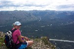
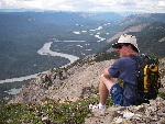
Rich, on the bench (almost) on top of the Mtn.
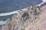
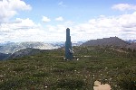
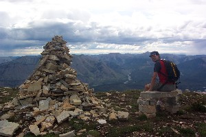
At the top of the ridge is a pile of rocks that others have built up. I’m not sure why, I guess kind of like graffiti some one wanted to show they were here. The rock bench however, I like very much. There are great views up river, down to the campsite. The falls are some what obscured by the bank. Looking away from the river is a radio tower, and you can see the actual summit of Sunblood Mtn.

Communication Tower and picture of the peak
The weather threatens to rain, but when it does it is just a sprinkle. We head back down the only real way we can, which is the way we came up. We stop for a bit on the ridge line, Liz starts throwing rocks at the trees. When she hits the top of one and an explosion of pine cones results, we all start throwing rocks. Simple things for simple minds.
By the time we make it down I’m tired, and not really looking forward to the 2km or so portage we still need to do to get the canoes down to the put in. But still it was a nice hike and worth it.
|