Trail Cafe: Trip report - Hiking Prairie Mountain
Summary:
Title: Hiking Prairie Mountain
Trip type: hiking
Summary: A short half day hike, amongst the Pine trees,
Author: M. Tanton
Date of Trip: may 2011
Country: Canada (Assumed)
Province: Alberta
County/City/national park/etc: Kananaskis
Location Route: Prairie Mtn
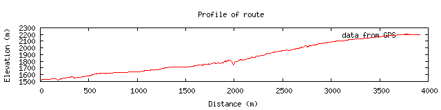
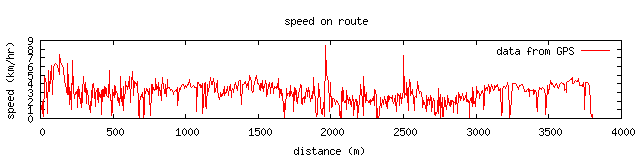
Distance: 7km, 3.5km out and back
Elevation Gain: 700m
Weather Conditions:Cloudy and misty
Directions to Set in or Trail head:
29 km West of Brag Creek on hwy 66, just past Elbow Falls Picnic area.
Partners: B. MacDonnell
Authors Trip Rating: Easy
|
 |
Download Track, in GPX format (right click select "save as..." or 'download' as required)
|
Trail Description:
The trail head starts after the entrance to the elbow falls picnic area we parked on the road, but it looked like ther was a parking lot just down the road a bit.

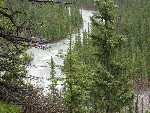
elbow river
The trail starts on the north side of where a creek (name=?) crosses the road. It starts off steep. Do not take the trail that runs up alng the road; rather go up along the ridge to start. There are a few branches in the trail here for the firs 100m or so. Right away you are rewarded with a good view of a fast running section of the elbow river above the elbow falls.
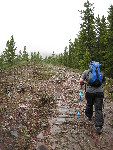
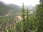
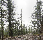
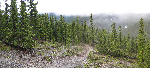
The trail is quite wide, and runs through the pine trees just like most of the trails in the area. The elevation gain slows a bit and it is a fairly easy hike for the next km or two. After a km or so it opens up and provides a view of both the elbow valley and the valleys to the south, although today the views are a bit muted by the low laying clouds, which chop off the tops of all the hills, and do not allow the blue of the sky to shine through.
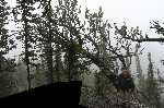
The side of the hill above the creek is clearly subject to wind at times. It has made for some interesting trees.
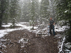
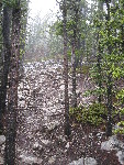
Getting into the snow.
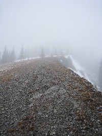
About 2/3rds of the way through the trail suddenly becomes steeper. Today with the rain the wet trail and a bit slick. It becomes more so as we get to patches of new snow that is covering the trail in spots. We also enter the mists.
The trail comes to a fairly open glen as you aproach the top. I suspect there is a great view to the east, overlooking the elbow river. Maybe you can even see the falls? We can't though, we are socked in with the trees in out 50m or so looking like they are not quite in the same reality as we are.
Getting near the top. Carin up at the end.
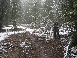
We've been following some one up the hill for a while; we could see the fresh tracks. He appears without a sound out of the mist in front of us. The only person we see this day on the trails. It is a weekday, pretty cool, and a bit gloomy. It makes a good day to get away from the noise if the city.
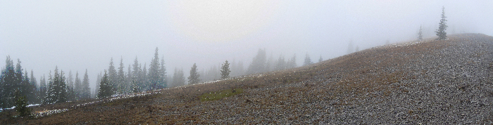
Along the ridge... there is a good view here somewhere I'm sure.
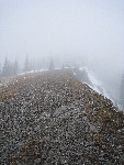
We take a short stop at the top. There is a large carn here; obviously the hike is not too long to tire some out. A ton of rock was piled here. The cool weather gives the wind a bit of a bite. There are no real views with the clouds wrapped around us and we are soon heading back down.
The hike from start to finish took about 3 or so hrs, going at a relaxed pace.
At the bottom we walk over to the elbow falls picnic area to cool down our legs. There is not another soul there, which is a first for me. We spend a bit if time watching the not yet flood level but high waters go off the brink of the elbow falls.
Gallery
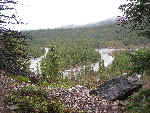
First views of elbow river.
|
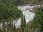
elbow river
|
heading out after the first climb
|
elbow river at the start
|
early view
|
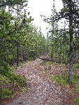
A well travelled trail
|
IMG_0846.JPG
|
Heading into the mist
|
starting to climb again
|
Getting into the snow.
|
Along the ridge... there is a good view here somewhere I'm sure.
|
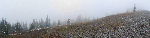
Getting near the top. Carin up at the end.
|
this could have been a fantastic shot.... oh well hold you hand over the dark bit
|
Trail on the way out
|
in the clouds
|
[an error occurred while processing this directive]
Content Copyright © M. Tanton 2011


