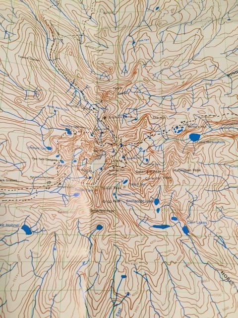
The Trip Report:
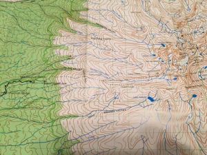
The second part of the map to show the Peak Circuit path and the way out.
Hiking Mt Kenya was an unforgettable experience! Even after two years, my memory of our five-day hike in Mt Kenya was still as fresh as if it happened yesterday.
Chris and I went to Kenya in the end of 2014 to do some Safari and climb Mt Kilimanjaro. We decided to add Mt Kenya on our itinerary since we were there already. Also, as the second highest mountain in Africa, Mt Kenya could acclimatize us for for climbing Mt Kilimanjaro. However, it turned out that it was a way better hike than Mt Kilimanjaro in many ways...
Let's start with Peter and his support team. To climb Mt Kenya, getting a guide was not mandatory. So in the beginning, Chris and I were thinking to go by ourselves, of course, to save money. After doing a lot of research on the Internet, we sadly learned that there was really not much information available -- at least no free maps that was detailed enough, and not much trail reports from other hikers. And more over, there were many options on guide companies but not much information on how they were doing. We nailed down to two: one of them didn't get back to us in time, and Peter replied us immediately with detailed trip plan, then based on our requests, he revised the plan accordingly. When we finally finalized our trip plan, it was already the day before we left Calgary for Africa. Peter took the risk of arranging everything for us without any deposit. We only decided to meet at an intersection near my friend's house at 6 am 9 days later on Dec 17 -- just like in the old days:-)
Day 1:
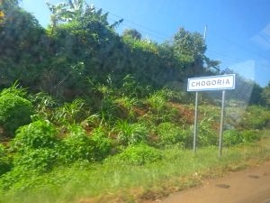
Entering Chogoria Town
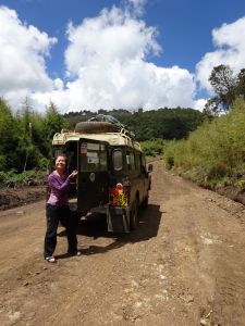
Then 9 days later, we met at 6 am in dark at the intersection near my friend's house in Nairobi on Dec 17, 2014. Peter and his long term business partner/friend Moses showed up to pick up Chris and I in a compact four door car. Chris and I were comfortably sitting at the rear seats.
It took about 4 hours to Chogoria town which was on the far side (east) of the mountain, about 225 km from Nairobi. The support team that Peter had hired were already transported from Naro Moru town (west side of the mountain) to Chogoria the night before with most of the groceries needed for our trip. There were three porters: David, Charles and John; and one chef Joseph.
Peter let Chris and I wait in a restaurant for brunch while he went to get his guys and the vehicle. In one of the gazebos at the Lenana Restaurant, we saw that the Chogoria Hospital was at the next door. For one second, Chris and I were thinking to pay a visit. Then decided that was not a great idea since it wouldn�t be fun if we caught any infections while we had to climb Mt Kenya and Mt Kilimanjaro in the following days. However, we learned later at the National Museum that the Chogoria Hospital has some historic significance in Kenya. It was established in as early as 1922. So we kind of regretted that we hadn�t paid a visit when we were there.
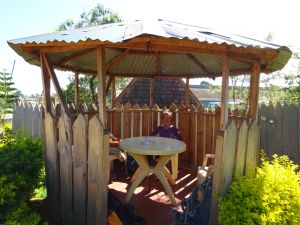
Sitting in the gazebo in a local restaurant
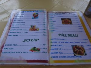
Menu
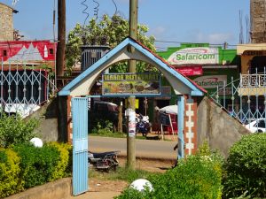
Street scene
Anyways, Peter picked up us and we met our team and all squeezed in that 4x4. We needed to drive 32 km from Chogoria town at 1650 m to the Park Gate at 2950 m.
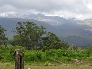
It was a very scenic drive. As we gain altitude, the vegetation changed from farm lands, to forest, to bamboo zone, to timberline and then heathland and chaparral.
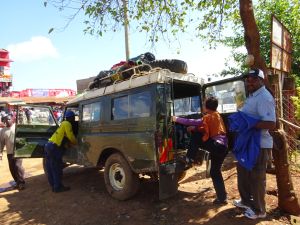
4x4 that would take us to the park gate
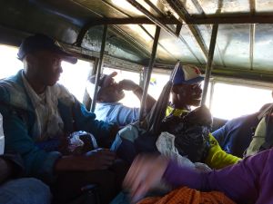
Meeting the team in the stuffed 4x4
At about 2/3 of our ride, we had to stop. Everyone were kicked out of the vehicle -- the poor engine was overheated. We had to let it cool down before continuing:-). And this last 10 km was the most steepened section where usually was hiked up. Only because we wanted to squeeze the Peak Circuit Path into our five-day hike, Peter arranged the 4x4 to drive up this 10 km so we could spare half day for the Peak Circuit.
Letting the engine to cool down
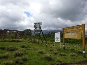
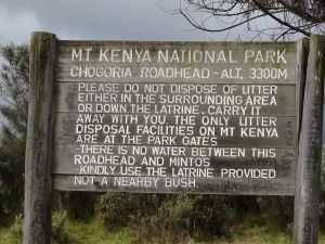
We finally arrived at the Park Gate around noon. The 4x4 returned, left us, and all the equipment and groceries... that we would need for the next five days for seven of us.
Park office
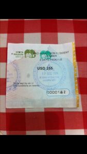
Park permit
Park entrance (left side)
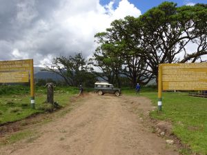
Park entrance
Scenery from the gate
Kitchen for lunch
Our lunch was set up on a red/blue braid blanket, served by Joseph, the cook. Chris and I each got a plate of hot food: hot tomato sauced beans and instant noodles, and fresh fruits: mango and banana.
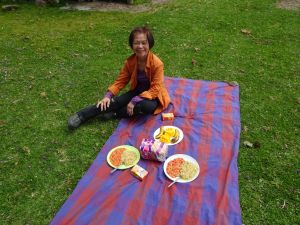
Picnic under the tree
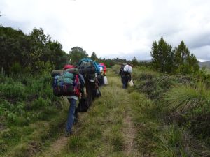
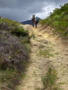
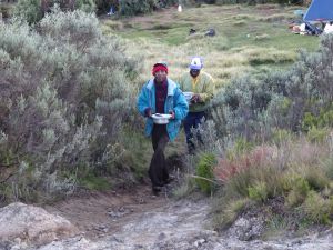
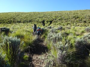
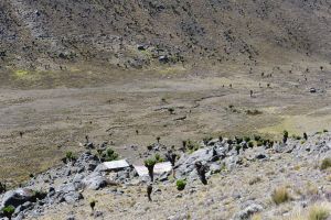
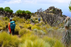
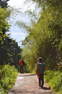
After lunch, Peter took Chris and I on a hike towards our first campsite. We carried a light backpack. All other stuff was carried by the porters. We left first and they stayed behind to clean up and pack up. But soon, they caught up and passed us. They went ahead to set up our next campsite and prepare our dinner. Same story in the following days.
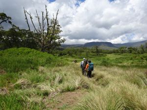
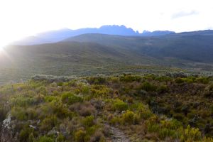
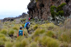
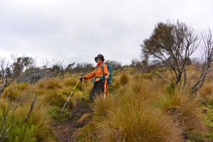
Walking towards the first camp
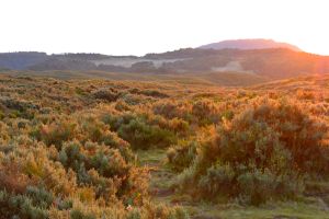
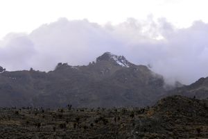
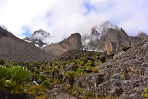
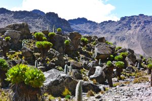
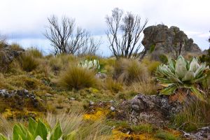
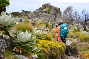
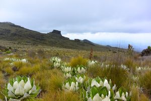
The Chogoria route is known for its beauty...
Scenery along the way
Porters caught up
There were supposed to be many wild animals in this part of route. Unfortunately, we didn't meet any elephant, zebra, or buffalo. I only saw the black shadow of a half-foot long snake.
But the hike was easy and very enjoyable.
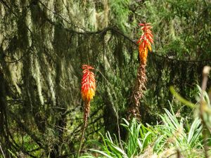
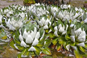
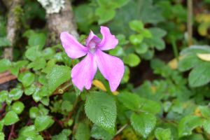
Red hot poker, usually seen at 3000 m
Going over a small hill
Look, the stick on Peter�s backpack was not a hiking stick; it was an umbrella!:-)
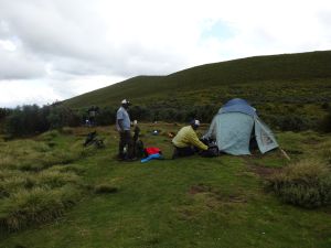
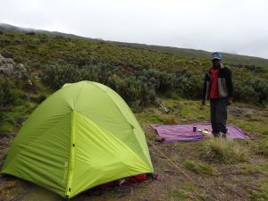
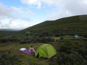
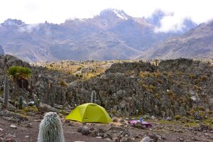
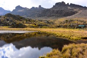
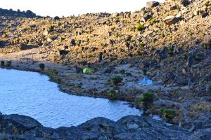
We walked around 10 km and arrived at the Road Head Campsite about three hours later. The elevation was about 3300 m now.
Roadhead camp at 3300 m
Peter and porter's campsite
Our tent was already set up. Sleeping mats were in the tent, as well as our big backpacks in which we had our sleeping bags and clothes. While we were waiting for our dinner, it rained, light, but quickly brought the temperature down. But when we came out from the tent after the rain, the rainbow was stunningly beautiful!
Our campsite is on a small hill
Very quiet campground -- only our group that night
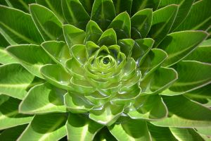
Lobelia
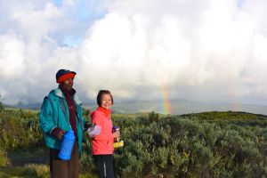
Double rainbows!
Sunset at the Roadhead camp with the peaks in the background
Since we were from Nairobi 1800 m now to 3300 in one day, I had a little bit headaches. I took two regular Tylenols and I was ok the next morning.
Dinner is ready
The hot dinner was very nice in the cold mountains. The chicken and the local fruits were very tasty.
We had a good sleep after a long day.
Bed time
Day 2:
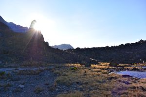
We got up around 6. It was bright (sunrise at 6 am around the Equator). We washed our face and teeth in a little creek. The water was freezingly cold, just like that in the Rockies, although we were near the Equator.
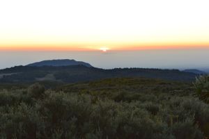
Sunrise at the Road Head Camp
Sunrise at the Road Head Camp
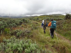
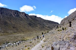
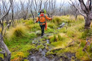
Our breakfast was nicely served as well. Then we started our 14 km hike with our packed lunch.
Hiking in grass land
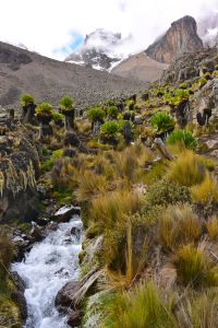
The walk was along the right hand side of the Gorges Valley.
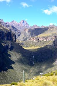
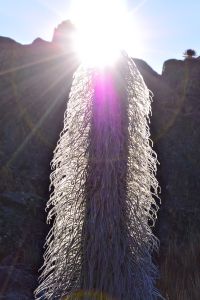
The Gorges Valley and Vivienne Falls
Had lunch at the lookout by the giant Gorges valley facing the Vivienne Falls � stunning view!
Peter set a very slow pace to help us acclimatizing.
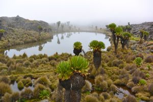
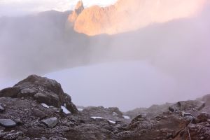
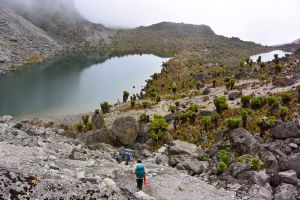
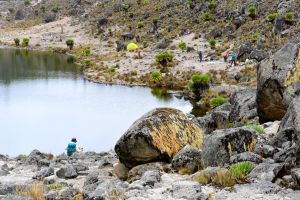
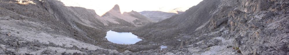
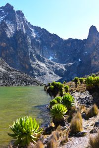
Lake Michaelson
Around 2:30pm, we arrived the Mintos Campsite at 4300 m. Luckily we arrived early. While we were taking nap in the tent, it rained/hailed. When we came out, it was all white, but melted soon.
Our tent at Mintos Camp
Porters' camp
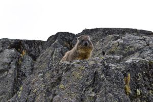
Mt Kenya Hyrax
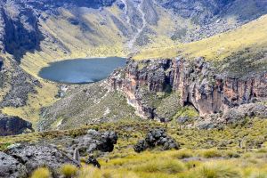
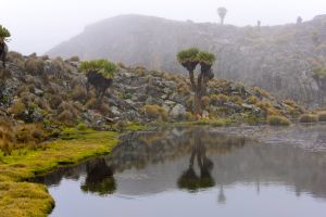
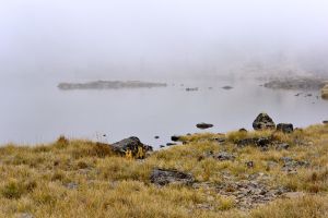
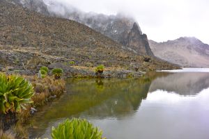
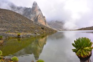
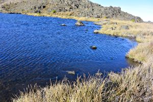
There were a few lakes nearby...
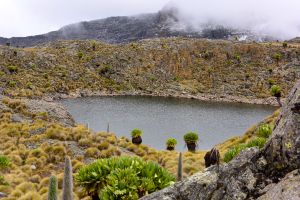
Small lake near the camp
Point Lenana at the far back
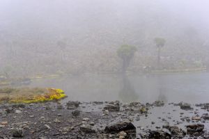
Heavy fog after a short snowing in the afternoon
Beautiful lakes nearby
Trail to the Point Lenana
Point Lenana from Mintos Camp
I already started feeling the high altitude and had to move slowly. But we had enough time to explore this area and I got so many beautiful photos. We could see the Point Lenana where we were gonna climb in a few hours.
Dinner was a bit early so we could go to bed early, and prepare our summiting the next early morning. We needed to start at 1:30 am in order to see the sunrise at the peak.
When we were preparing the clothing for summiting, I found out that I stupidly grabbed a wrong bag, so I didn't bring my merino under layers... Luckily I had a pair of ski pants so I could put them outside my thin hiking pants.
Day 3:
Then, stupidly I set up the alarm on my phone at the wrong time. So Peter had to come to wake us up. So we were 20 mins behind schedule. We had a few pieces crackers and had hot tea in their hut before heading out.
We left the campsite shortly after 2 am. And the sunrise would be around 6 am. We had less than 4 hours to walk 4.5 km and climb 700 m from 4300 m to 4985 m.
Walking in the night was actually very enjoyable. The air was cold but so refreshing. It was a cloudy night so there was no moon and the visibility was limited. We simply followed Peter's step. The first part was moderate and the trail was nice. Peter set a very slow pace. It might be too slow for us at trail like that, but it was above 4000 m altitude. And it did help to preserve energy for the summiting.
At one point, we got lost for a few hundred meters in dark:-). It was at the foot of the peak. We retracted a bit and then started going up. There were two steep sections: steep up then flat then the final push.
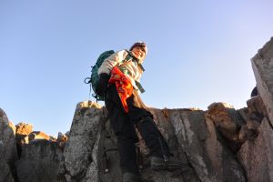
Now, I got excited since it was getting closer to the peak. The first steep section was scrambling and it didn't look like a trail. We just followed Peter and kept going up and up.
The final push had some switchbacks. We started to see lights closer to the peak -- from people using other ascending routes where the campsites were closer. At this time, our feet were getting heavier and heavier. I needed to make effort to keep moving forward. But at least we were still keeping a steady pace and moving.
We started passing people while getting closer to the peak. We saw a girl who was sitting there and couldn't move. It was one of the typical high altitude reactions�locked up muscles.
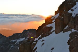
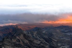
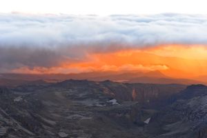
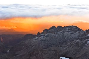
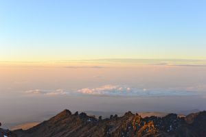
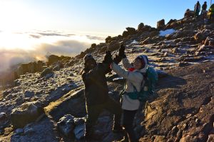
The top part had quite a few scramble sections. We got slowed down because there were a few people ahead of us who had difficulties in scrambling. And at this time, the sunrise started. Everything under the early sunshine turned orange. We were around the same height as the clouds, so we could see both above and under the clouds...
Sunrise started
Morning sun hit on the peak behind us
Sun came right behind the mountain
The valley in the morning sun (left)
The valley in the morning sun (middle)
The valley in the morning sun (right)
Chris
Peter
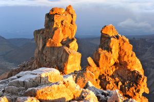
Rich colour
Colour changing
Getting brighter
We kept moving the last a few meters while I couldn't stop taking photos from every angles, just breathtaking!
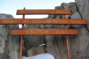
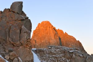
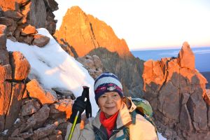
The highest Via Ferrata in the world
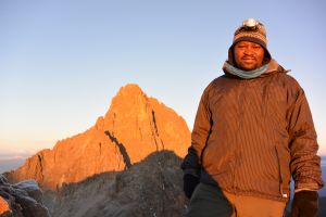
After having climbed a few metal bars (claimed allegedly the highest Via Ferrata in the world at 4985 m), we stood on top of the peak, the third highest point of Mt Kenya, while the orange Sun rays were dancing on our faces!
Last a few steps
Summited!
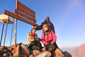
The moment
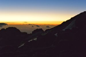
We spent some time up there and enjoyed the view of surrounding peaks. But it soon became so foggy and we could barely see peaks nearby, including the highest and second highest peak next to us. We were told that in a clear day, we could even see Mt Kilimanjaro� No luck on that!
Foggy again
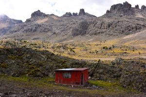
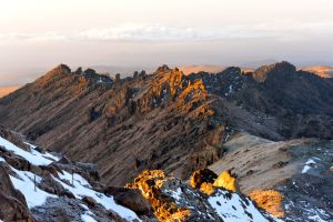
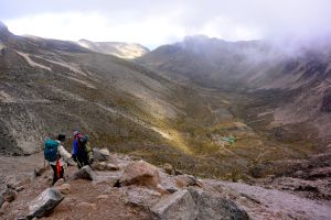
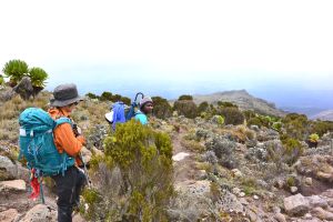
The descending route was a different route, and it was pretty much straight down, so it was very fast, took us about two hours to reach the Shiptons Camp. The views during the descent was awesome as well since we were facing the grand MacKinder Valley the whole time.
The Shiptons Camp (green buildings)
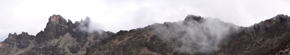
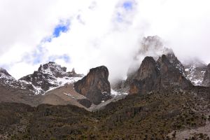
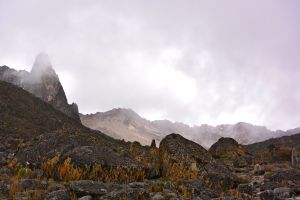
Surrounding peaks
Heading down to the valley
Looking back: we came down from the peak on the far left
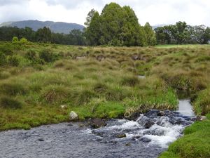
At the lower section, the trail follows a creek that is the source of Liki River, which eventually joins Ewaso Ng�iro, one of the two major rivers in Kenya.
Creek along the trail
The Shiptons Camp is one of the main camps. It actually has a real building with real beds and flash toilet for hikers! Soon after we got there, our hot big breakfast was ready. It was definitely a wonderful retreat after the summiting hike. By this time, we have already hiked 7 hours. Chris and I felt very tired from the hike and lack of sleep.
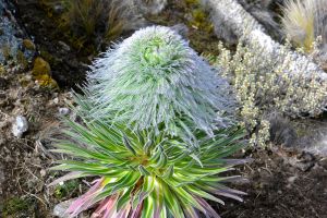
Baby Ostrich Lobelia
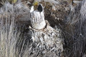
Dead Ostrich Lobelia
Cabbage Lobelia
Our original plan was to stay at the camp for that night and do the Circuit Peak the next day. Since we finished so early and were not dead, Peter suggested continue our hike and do the Circuit Peak. This way, we would move to a quieter campsite at 4600 m. It could help us to acclimatize for our hike on Mt Kilimanjaro next week. He was so thoughtful! We really appreciated his flexibility. This revised plan did help us a lot with acclimatization and made our Mt Kilimanjaro hike a lot easier.
Came down from the left earlier, now going up on the right
Peter also "kindly" let us took an hour nap before continuing. Chris had a nice sleep in her sleeping bag. I was too lazy to take off my boots, and slept half covered in my sleeping bag. That was a huge mistake! The room had no heating system at all, and it was freezingly cold in the morning, with all the moisture from people stayed there the night before. My feet were so wet that soon they became freezing cold. But I was too tired and lazy, so I just let it be. I found out later that it was actually hot outside under the sun... After about an hour nap, I got up with sore throat and bad headache. I started taking medicines and tried to cover it, but I started to feel very sick.
While other hikers showed up at the Camp and started celebrating their summiting, we headed out and continued our journey...
The sun was getting hot, but I actually appreciated walking outside rather than staying in the damp and cold camp. I was very sick, plus the high altitude reaction, I barely could follow Peter although he was walking really slowly.
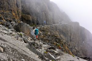
Soon after we left the camp, the trail started going up steeply. And I remembered that the trail wasn't clearly built, and there were barely trails in some really steep sections.
Our porters caught up us when we reached the Hausberg Col. After a short break, we started descending. The first part of the descent was scree which was Chris and my favourite, so we just happily slid down. The bottom section was very rocky and had some scrambles.
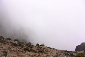
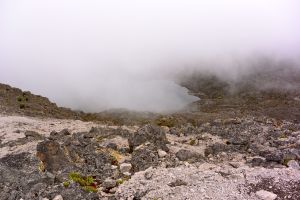
By this time, it became very foggy again.
There were two beautiful tarns (Hausberg Tarns) on each side of the trail. Now it was so foggy that we couldn't see too far except for the small lakes and the trail ahead of us. All the mountains were hidden behind the fog. But the air was nice and cool, perfect for hiking. Very enjoyable. And made me feel a little bit better.
Hausberg Tarns
Shortly after passing the lakes, we started going up again. But this time the trail was more rocky and had some scrambles. The trail seemed so steep and endless to me by now since I was so exhausted. Every step needed effort. Sometimes I felt I couldn't keep up Peter anymore...
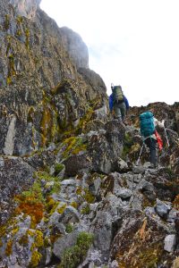
Climbing up
Because it was so foggy, we could only see a few meters away, so we didn't really get chance to see any scenery which was supposed to be stunning...
Looking down the cliff
Also because it was so foggy, I couldn't see how far ahead of us, just walked, walked and walked with my tired legs...
Finally we reached the top where Chris and I finally got a chance to catch up our breath. I saw Peter put both his arms on the rock wall, and buried his head between his arms, looking like praying. I remembered that there was a tribe called Kikuyu in the southwest of the Mt Kenya who worshiped Mt Kenya as their God. And Peter was also from that area... So after a few minutes when he was done, I asked if he was praying. He said "No! I was just catching up my breath..." So we learned that summiting and doing the Circuit Peak on the same day could kill an experienced mountain guild like Peter as well:-)
From there, the path was flat and wide. The next morning when it cleared up, I came back and found out that it was actually at the peak part of a steep mountain where there was the rock wall on one side and the big cliff on the other. The bottom was a giant valley (Hausberg Valley).
Hausberg Valley underneath
After turning left, and passing a small tarn (Nanyuki Tarn) there were a few steps going uphill, then a bigger tarn (Hot Tarn) showed up. I was soooo happy to see our little yellow tent set up there by the lake and our porters there preparing dinner! This meant that we were finally done with the day! I couldn't wait to lie down in our tent! But it was only around 3 pm in the afternoon and our dinner wasn't ready yet.
Nanyuki Tarn in fog
A short uphill before seeing the Hot Tarn
Nanyuki Tarn in fog
Hot Tarn in fog
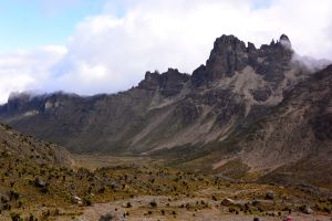
The peak on the left -- Pt Piggott
Our yellow tent and porters' tent
The Hot Tarn
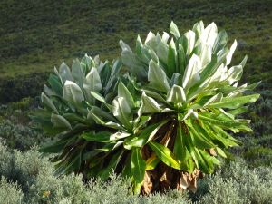
The hot Tarn and Giant Lobelia
Now the elevation was 4600 m and it was a cold day. Because of the heavy fog earlier, even though it got cleared by now, there wasn�t much sunshine before sunset. So soon it got really cold.
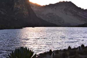
Sunset at the Hot Tarn
I had very poor sleep because I didn't have any comfortable under layers, I was wearing damp and cold hiking pants in the sleeping bag. It didn't help on my sore throat and stuffed nose. I couldn't breath well for the whole night. Now thinking back, those symptoms were likely related to the high altitude reactions.
Day 4:
We got up in beautiful sunrise.
I got many nice photos in this area before breakfast. We were very relaxed since we had done all the hard work and had achieved both of our main goals! From now on, we only needed to walk down hill and enjoy the sceneries.
The Nanyuki Tarn in sunrise
The Hot Tarn in sunrise
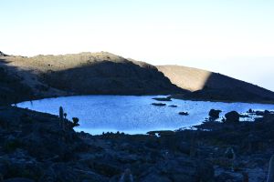
The Emerald Tarn at the bottom of the Hausberg Valley
Pt Piggott in sunrise
The Nanyuki Tarn in the morning
Ostrich Lobelia
The Hot Tarn in the morning
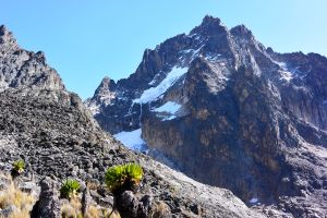
The Batian Peak and the Tyndall Glacier
The Naro Moru route from Two Tarn to Meteorological Station was amazing! The view changes every half an hour or so!
First from the Two Tarn, we went forward and went down to the last Valley (Teleki Valley) which concluded our peak circuit of Mt Kenya. Although we did only three quarter of the circuit, we covered all the views. In the last valley, we got a closer look of the Tyndall Glacier, which was between the Batian peak, the highest peak of Mt Kenya, and the Pt Piggott peak. It was a lot smaller compared to years ago. At the bottom of the valley, there was an abandoned American Camp. People used to take this route up on the glacier when the glacier was touching the bottom of the valley. Now, the glacier was shrunk to the very top of the peak.
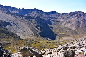
Looking down the Teleki Valley
A lot of Giant Lobelia and Ostrich Lobelia at the bottom of the Teleki Valley
Turning right along the right hand side of the valley, we kept walking out. There was a Ranger�s Post. But we didn't see anybody.
The Ranger's Post
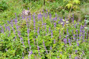
We crossed the creek at the bottom of the valley shortly after the MacKinders Camp, and ended up walking on the left hand side of the valley. There were a lot of Lobelia, and Senecio blossoming with tinny flowers.
Walking on the right side of the valley
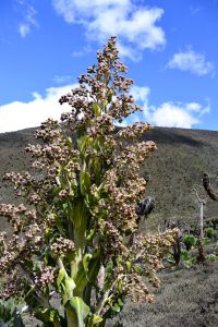
Flowers of Cabbage Lobelia
Lobelia Keniensis, like lotus
Swing to the left side of the valley
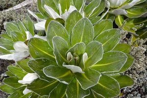
Cabbage Lobelia
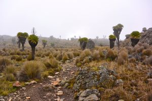
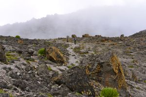
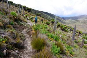
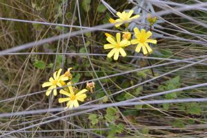
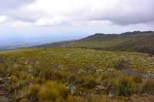
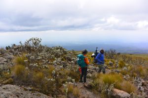
The view suddenly changed when we walked over the hill, and it became a very flat high land with bushes and many wild flowers -- Gladiolus, Helichrysum, Carduus� and many more that I don�t know the names.
Entering moorland
Mixed vegetation of sub-alpine and moorland
Walking through grass
Trail could be very narrow
Open view
We had lunch beside a huge rock. We had our last piece of chicken. Chris and I had this chicken since the dinner on day one. The porters had to use ice (on the first day) and mountain snow (on the following days) to preserve the chicken till now. They also had to carry all the cooking stuff including gas and drinking water, and our backpack... Everyday, they packed after we left the campsite, and caught up with us, fully loaded, and then passed us, and set up everything at the next campsite, and got dinner ready for us... For backpackers like Chris and I who got used to do everything on our own, especially cooking after a long day hike, this was really a luxury trip to us:-)
Picnic by the rock
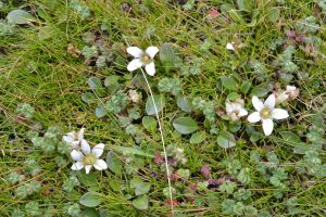
Tiny wild flowers
Tiny wild flowers
Tiny wild flowers
Tiny wild flowers
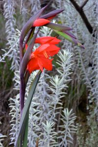
Wild Gladiolus
Looking downhill
After lunch, we continued our hike, but now there was a big mash area where we had to follow Peter's steps sometimes to avoid dipping into the mud. And the grass looked like the bear grass that we have in the Waterton area in Canada.
Continue our journey
Around 2 pm, it rained. Now we saw why Peter carried a big black umbrella on his backpack. Chris and I had ponchos and they worked fine in the light rain.
Shortly after the rain, we walked into the moorland with short bushes. That was where I remembered to ask Peter where the Equator was. We were supposed to cross the Equator twice during our trip, and we already missed the first one. Peter felt so sorry to tell us that we just missed the second one:-(. It was during the rain when we passed the Equator and no one paid attention. As no one wanted to walk back, I took a photo of Chris as our pseudo-Equator photo since it was about 1 km from the real Equator.
The Equator is about 1 km north of the spot
Soon we went into forest and we knew we were getting closer to the campsite.
Wetland
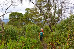
Entering rainforest
Rainforest
Wild Orchid
It was getting hot at the lower altitude.
It still took us quite a long time to walk the last few kilometers. The trail turned into a road. Peter has disappeared since there was no way for us to get lost. And I took time to take more photos.
Bamboo forest
Wild flowers
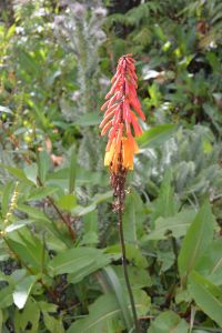
Red Hot Poker
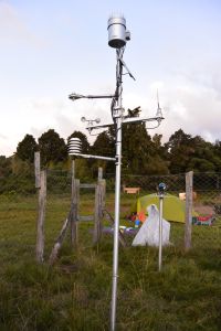
We finally got to the Meteorological Station. I quickly removed all the layers and socks, had a really nice wash at the water tap. Felt really refreshing.
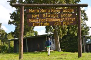
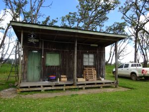
Met Station Camp
Now we were at 3050 m. It was nice and warm. My sickness was all gone.

20 C above, take off all the extra layers
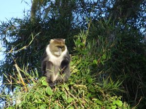
Little visitor at the camp
There was cell reception, but only under one tree. And you had to lift the phone high to receive the signal. And the signal was so weak that it could take a long time to download/upload a short email. That was why they built a little wood deck on the tree trunk about 2 m from the ground -- to let people put their phones there to download/upload data:-)
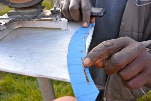
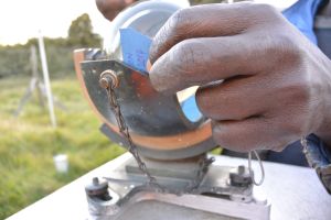
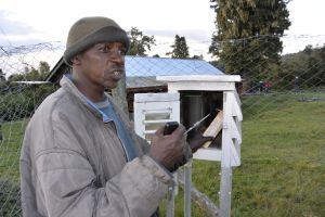
We also visited the Met Station and Patrick, the guy working there, showed us their equipment. I wasn't familiar with meteorology so everything looked interesting to me.
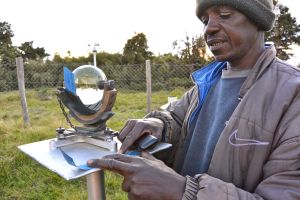
Patrick was explaining how things work at the Met Station
How the sun hours were recorded
A new slip for the next day
Recording temporatures
A combined equipment
After being the only group camping in the past three nights, it was the first time we saw other people at the camping site. But we didn't see where they were actually staying. We were still the only tent in the yard.
We slept in the tent in the yard while Peter and porters stayed in the brick building. Before bed, Peter came to remind us not go out if we heard any sound -- that would be from buffalos eating grass in the yard. But he assured us that they wouldn�t bother us. Yeap, he was right! I took a peek in the dark later on when we heard some sound and saw buffalos not far from our tent... I went back to sleep pretending there was nothing out there�
Day 5:
Walking down in the forest on a road that was so wide that it could run cars. Passed a bamboo zone and Peter took us into the bamboo forest which was a very nice sidetrack from the official trail.
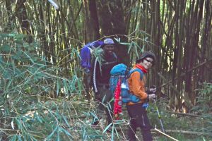
Walking through the bamboo forest
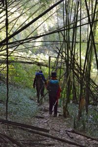
Walking through the bamboo forest
The last 10 km was easy and relaxing. Two hours later, we saw the Naro Moru Park Gate.
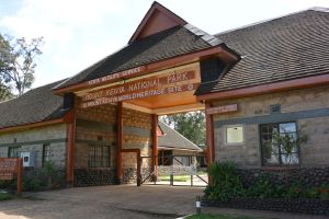
Park Gate at Naro Moru side
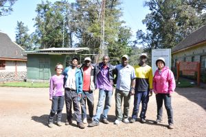
From left to right: Chris, David-porter, Charles-porter, John-porter, Peter-Chief Guide, Joseph-chef, Moi
From there, we took bus to the town of Naro Moru where we could catch our ride back to Nairobi. The bus stopped a few times to unload our porters. Watching them leaving the bus and going home, I felt I should have spent more time to know them more, where they lived, who were their families and kids... On the other hand, thinking of that our tips could help on their living also made me very happy�
One day, I will definitely revisit Mt Kenya, let Peter take me to see different parts of Mt Kenya, get to know more local people, and maybe challenge Batian the highest peak which requires alpine equipment!
Note:
Peter Mburu
High Peak Safaris
highpeaksafaris@gmail.com
+254722687008
www.highpeaksafaris.com
|