Hike: Cory Pass - Banff, Alberta, Canada
Quick Summary
Difficulty: Moderate - hard depending on route
Distance: 15 km
Elevation gain: 1000m
Time Taken: 4hrs (unfinished)
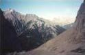
Cool points: Scramble through rock-slides, good views down
the lengths of two valleys.
What it's Not:
Date of Hike: Mid Sept 98
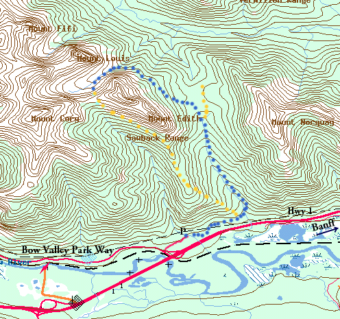
Map Note: The blue line indicates the route taken. We stopped and turned back.
Recommendations: Leave in the morning, if it is a hot day take
the west side of the loop first, to try and maximize shade. Otherwise
go the east route first.
Notes: This hike is a loop. There are several scrambles
up to the Edith and Cory peaks. We did pass signs saying no mountain
bikes, but we were also passed by some mountain bikers
|
"Map is © Her Majesty the Queen in Right of Canada,
Department of Natural Resources. All rights reserved."
map from the website http://toporama.cits.rncan.gc.ca/toporama_en.html
|
How to get to the trail head
This hike is not to far outside the Banff town-site. Follow Hwy 1 west
past the Banff tow-site, turn right on Hwy 1A (Bow Valley Parkway),
about 6km west of Banff. Take the first
right (about 20m). The road starts out paved but quickly becomes gravel,
it ends at the trail head (about 1/2 a km from the start of the road)
Ramble on about the hike
The trail head of this hike crosses a small creek (via foot bridge)
after which is a out door fire place, and several picnic tables. This
may be a good spot to have a after hike meal.
The Trail follows parallel to Hwy 1, this is kind of annoying to say the
least, however it is only for the first km or so, and the sound
of the vehicles are quickly muted as you turn north into the loop of the
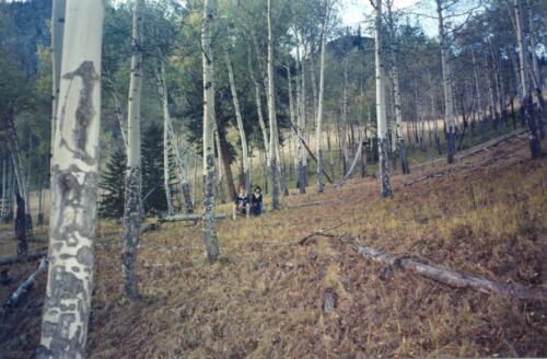
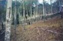
hike. The first portion of the hike you are passing through spruce, and
Douglas fir trees (I think), and you come into a sparely populated
grove of poplar trees. This struck me as quite nice, especially in sept
when all the trees had a yellow cast to the leaves. It gave the
impression of coming out of a dark forest into a nice bright glade.
from here you can see up the side of Mount Edith. at the end of
the popular grove is the fork in the path where you either go
pretty much strait up the mountain to the pass between Mount Edith, and
Cory Mountain just to the west of it, or around the back side
of Mount Edith, and come to the pass from the North West.
We chose the back side, as it would be in the shadows
first, and I still had hopes of making the full hike.
From there the right 'fork' in the trail continues east past
Mount Edith. In here you see some pretty big douglas fir trees (at
least for Alberta). The trail eventually turns north up the
valley between Mount Edith and Cory mountain. This trail is quite
well traveled at this point, and is a gentle climb through the
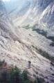
trees up the valley along a small creek. At one point the trail
skirts along the stop point of a 'fairly fresh' rock slide, I thought
that was pretty cool, having trees on three sides of you and then a
clearing of rocks on ones side. I guess I have always enjoyed comming
out of trees at any time on a hike, 'sudden' transition, and ability
to see is quite refreshing.
The trail comes to a point where it splits into the Cory pass and
the Edith pass. There is a sign here, were someone had taken the
liberty of scratching in the the words 'Very Boring' beside the
arrow pointing up Edith pass, well we were going on Cory pass
anyways. From here the
trail veers west a bit, and the trail becomes a bit smaller and
a bit more difficult, although still quite easy. Now on the east
side of Mt. Edith mountain the trail
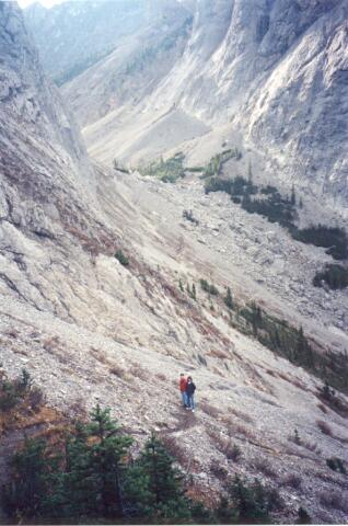
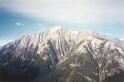
eventually comes to a old rock slide that has to be crossed, here
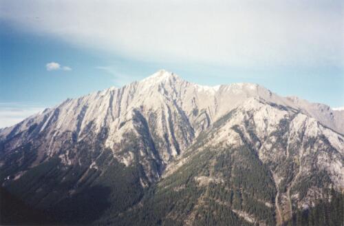
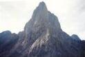
you get the first good view of Cory Mountain, and Mnt. Edith across
the valley. Don't take to many pictures yet, though, there is better
just up the trail. About 1/2 a km up the trail you come to another
old rock slide to cross, again you will get a good view, especially
of the three main peaks of Mt. Edith.

The trail continues into the trees after the 2nd rock-slide,
still moving mostly
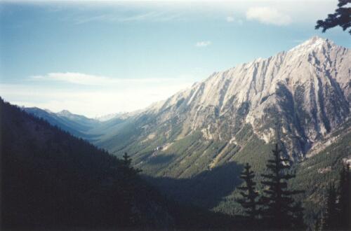
north, after coming out of the trees again the trail takes a
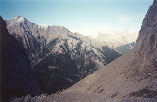
quick turn west, here you will get a good view north up one of the
valleys.
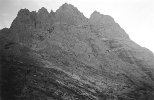
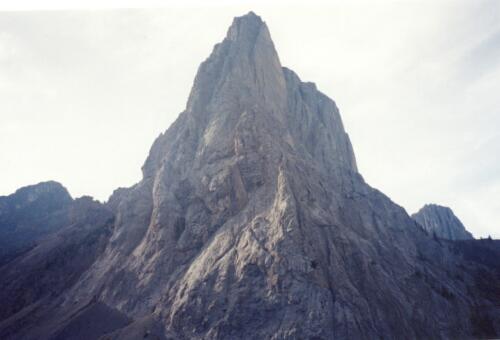
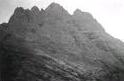
The this point the most striking view is to the north west where the
trail leads. there is the very sharp peak of Mt. Louis that the
trail passes to the south of.
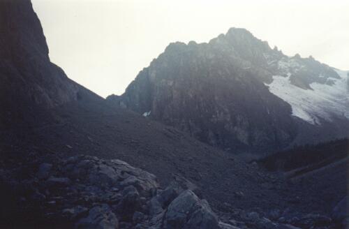
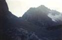
First you have to move down a bit, walking through the skree coming
down the north east side of Mt. Edith .
This is the first bit of difficulty for a for some one used to the trail up
until this point. I personally thought nothing of it, however the
two people I was with had a bit of a hard time (they ended up sitting
and sliding down parts of it). From this low point, it is a bit of
a scramble - of very easy difficulty (remember a easy scramble is still
harder than hiking on most paths) the
trail begins the assent up a rock slide. The trail is marked with
cairns. It is at this point in the hike
that we met two other hikers coming the other direction of the loop,
one of the stressed that we should consider heading back. It was now
5:30, and sunset is at 7:45. He felt that the climb up the pass would
take to long and that we would be in trouble walking down the steep
portion of the trail in the dark. I had already decided that if we
were not at the 1/2 point by 6:30 we would turn back, after talking
to these two, I decided that we would press on until 6:00, hopping
to at least get a good view from higher up the pass.
Up the rock slide we went, slow going, but in my opinion the most
fun portion of the hike. We made it to one of the crests in the
pass, and could see the trail now began its turn south, but still
involved gaining altitude, , it was now nearly 6:00. The two I was with were
pretty tired, I had been pushing the pace (for them) up until now,
as I really
wanted to finish. I decided to go ahead and see if the next ridge
was the top of the pass, I did not think it would be, but I wanted
to see. It was another 150m or so, alas, the trail still continued
up to the point which most likely was the apex of the pass. (is that
a contradiction? 'apex of the pass'?) but what took me 15 minutes would
have taken 1/2 an hour by the other two, so back I went.
The trip out took only about an hour (a 2:1 down hill to uphill
speed on a
gentle slope is easy to make) , it was still light enough to
hike (and remained so for another 45 mins or so) and being on the
west side of the mountain would have helped out there also, so I
am confident that we would have had no difficulty making it out.
We were however the last car to leave the trail head.
Addendum (2 yrs later) : actually I am not sure if we would have made
it out in the light, I found out later that one of the hikers I
was with (now my wife) is very slow when she comes down step
hills. And the part we missed was very steep and quite long (
500m drop over 500m (that is a long 45 degree decline, or
a hard hike up if you take the other route)
Lessons Learned on this trip.
This was quite a nice hike, however we never finished it as we got a
very late start hiking that day, we made it to about the 1/2 way point,
but decided to turn back as we were not yet at the apex of the pass, and
did not want to hike the trail in the dark. I am pretty sure we would have
made it, but better to error on the side of caution, especially in the
mths of sept, when it would have got pretty cold at night. So the only real
lesson is to start on time if able, it is pretty disappointing having to
turn back without finishing the hike
[an error occurred while processing this directive]