Trail Description:
This is my first ski trip of the season. Dec 16, 2007.
A solo ski trip today. Originally I was going to go for Bragg Creek, but at the turn off from Hwy 1 it did not look like there was much hope of snow. Plan B was Lake Minnewanka, with the ulterior motive to see if you can still get a sea-kayak on the lake. After, driving the long route to the parking lot, as the direct route is closed. I see the lake open up as I cross the dam. Turns out, the lake is nearly 100% open.
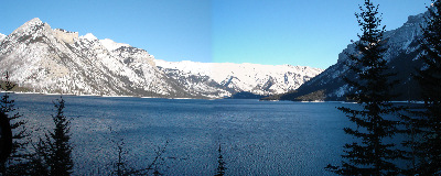
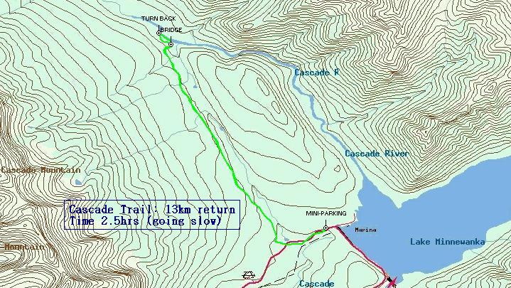
Lake Minnewanka from road _it's Dec 16 2006... and little ice_
The parking lot is full of cars, there are still a few people heading out, but most must be out on the trails already. Not surprising, it is pushing 2:00 as I pull in. I do a quick walk to check out the trail options. Initially I'm thinking a trip around (or down part way) along the lake. There are a couple of girls coming back from snow shoeing. There are some ski tracks, but they are will trodden upon. Heading back down the closed rode is a dual set of groomed ski tracks. That is where the others seem to be heading.
I'm without a map, and ask one of the guys getting back in. He tells me that he has never gone around the lake. He does recommend the other run, saying that it runs up hill most of the way, making for an easy return trip. Given my lack of conditioning, it sounds like a good trip for me, and I take his advice. Down Cascade (i think) trail I go. (it is the green line on the map). At the start of the ski tracks is a note showing that the road is closed due to it being a winter animal corridor. It shows pictures of wolves, and cougars.
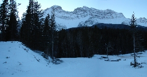
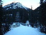
Cascade Mtn seen from road
The trail starts off very wide, and runs down a slight hill that is the road for the first 650m or so. There is a wide space between the two groomed tracks. Although the trail narrows later, it maintains a wide enough spacing to allow skating between them. After the 650m the trail turns to the right, and follows the fire road back.
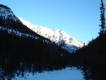
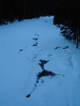
Looking back on trail as you head in
There is a small creek to the right, which occasionally shows itself. As promised It runs up a hill. There is not much view as you are in the trees. Looking back you can see the tip of Mt Inglismaldie and then occasionally the top of Cascade mountain it self to the left. The trail continues running uphill at a incline that allows parallel up hill skiing for a bout 3.5km. I took it pretty easy on the uphill climb, and was passed by several people, including an older lady 50-60s... sigh. So I'm sure people can do this run MUCH faster than I did .
It was more or less at the top, that a couple going the other way told me that the trail goes on for 3 days if you let it, a few km ahead is a bridge where many people turn around. The trail has a few more ups and downs, and then comes to a semi-steep decent. Just prior to this I was trying to make sure my GPS was working and was not paying to much attention. Just sliding down in the track. Suddenly my skis were flopping around... no more track. That is to say it is steep enough that people start to snow plough, and took out the track on the right side. This is the steepest grade on the section of the trial I did.
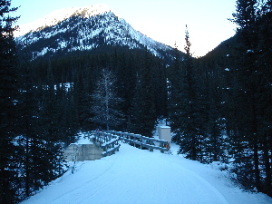
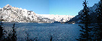
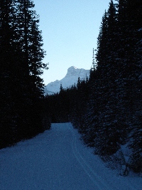
The bridge. The goal is in site
As you come to the river, the trees are far enough away to give you a bit of a view. Snapped a few pictures. The lady (the one I mentioned, not one of the other 3) that pasted me earlier, had stopped for some tea with another. I chit chatted a bit, and they told me that there is a short loop around the camp site here. I took that loop, which is about 6-700m, and headed back.
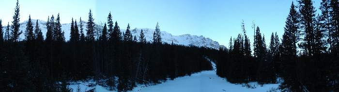
Looking up stream from the bridge.
On the run back as I was going down, I got a better feel for the hill. It was slightly surprising how long it was. It made going back much faster. At one point I was mildly concerned with how fast I was going. While going down a man was going up with two kids. One was in tow, pulled by a rope that was attached to a bicycle tire tube tied around dad's waste... brilliant. I think I know what I'm getting my daughter for Christmas now.
Took a picture of Cascade Mtn, after the junction with with main road, this taken looking back behind as I returned to the parking lot.
Well 13km, on a pretty easy track, at a pretty easy pace. My legs are gonna be sore tomorrow. Oh well, that's what you get for being so out of shape. But the stiffness will be worth it.
Driving back, looking out of Two Jack lake (which is frozen), I see 3 wolves down at the camp site. I try to get some pictures. But the camera zoom is not up to the job. They cross the lake. Two pics below. The first shows Mt. Rundle in the background. The speck by the open bit of the water is the first wolf to cross. I zoom in and catch all three as they cross.... still just specks in the picture though. Still, cool enough that I'm including the pictures.
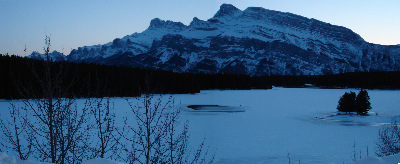
Mt. Rundle.
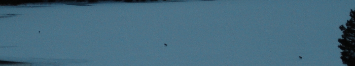
No Really the dots are wolves.
|