Trail Description:
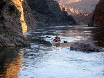
The river is all flat water, a few swift areas may be encountered with higher dam releases. Water level fluculates constantly.All of the rapids named in this section of the river have been drowned by another down river dam. Some are still very swift depending on water release from Hoover Dam. The most difficult one is Ring Bolt Rapid less than 1/2 mile above Arizona Springs. It is possible to portage this rapid on the Arizona side but it is generally passable. They were releasing record amounts or water during our trip requiring following back eddies along the shore and behind rocks in a few places. The release level was more normal on the last day of our trip and there were no swift areas as we paddled out.
The biggest hazard on this stretch of river is proabably cooking for too long in a hot spring. The Amoeba concern is real like in most hot springs but easily avoided by keeping you head above the water.lrrequiring some back eow Beach Harbor is located on the Arizona side of the Colorado River. The turn off is just 14 Miles south of Hoover Dam and another 3.5 miles off Highway 93.
Willow Beach Harbor is located on the Arizona side of the Colorado River. The turn off is just 14 Miles south of Hoover Dam and another 3.5 miles off Highway 93.
The approximately 50 mile drive from Las Vegas
The Trip Report:
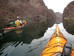
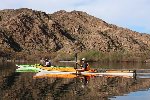
Black Canyon Bellow Hoover DamWhen I first saw a trip report on the Black Canyon of the Colorado it was intriguing but like a cookie twenty feet away from my recliner the journey just didn’t seem to be worth the reward. It was a 20 hour round trip drive for less than a 30 mile round trip paddle. Adding to the reward factor are items such as high cliffs on either side of the river, slot canyons to play in, various hot springs to soak in, desert bighorn sheep, a large variety of birds, and lizards large enough to feed a family of four. An e-mail from a good friend with a link to a trip report and the simple caption “I Want To Go” received on a cold January day tipped the scale. Like the tempting cookie I gave in and a several weeks later 4 of us were driving out of freezing temperatures for a few days of soaking up 75 degree sun and 100+ degree water.
The marina at Willow Beach was relaxed and casual enough to make Jimmy Buffet look uptight. When we ask where we could camp along the river the response was anywhere big enough for a sleeping bag. When we ask where we could park our car we got about the same response. Advice on the trip was simply paddle up river until you get to the dam, be careful of rapidly changing water levels, enjoy anything you find along the way, pack out your trash, and paddle back and pick up your car. There was also a vague warning about putting your head under the water in the hot springs. Like many hot springs there is the potential of an amoeba finding it’s way up your nose where it attaches to the back of your eyeball and sucks your brains out or something like that. Needless to say we kept our heads above water.
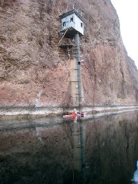
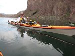
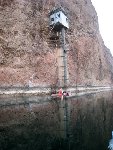
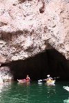
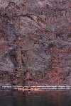
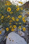
We paddled from the marina in the warm late afternoon sun and passed the fish hatchery where cormorants were busy stuffing themselves. A pair of mallard ducks adopted us and seemed to be very territorial when other mallards tried to move in on their potential food source. Yellow flowers and red barrel cactus decorated the hillsides and cliffs that were varied shades of brown and red. The occasional almost florescent bloom of the prickly pear looked out of place. A trail appeared on the Arizona side of the river. After winding along the hillside it led to a pulley cart which in turn led to a plank walkway that was suspended on a cliff about 50 feet above the river. The walkway led to another cable pulley cart that crossed the river to a small shack about 50 feet above the water. It looked like a wild trail to an outhouse with a spectacular view. It was actually a gauging station where some lucky guy had to show up to work every day before the dam was built. They just don’t make jobs like they used to.
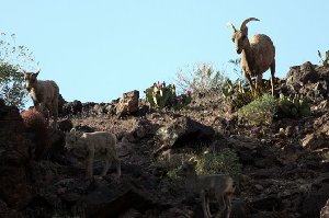
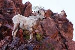
Just upstream from the outhouse in the sky we found a group of Desert bighorn sheep. It was a group of ewes and lambs, the rams generally stay in bachelors groups until just before the rut. Although this was the first group of sheep we saw it wasn’t the first group to see us. When I looked at my pictures after the trip bighorn sheep were on the cliffs above us from very early in the trip. As long as we kept our distance they didn’t seem to mind our presence. They were busy consuming what little vegetation they could find. They still had their winters coat and showed signs of a long winter with little food.
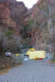
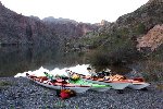
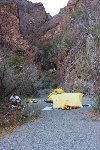
With no threat of rain we camped in the gravel in the bottom of a small slot canyon. After a good dinner we laid on a tarp looking at the small slice of night sky we could see between the cliffs. The concerns and pressures of work and life started to melt away much faster than the snow at home was melting.
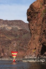
In the soft morning light and cool dry desert air we did our best to honor the casual advice we had received at the marina. With only a slight glance at the map and little planning we headed upstream. Dave took full advantage of an upriver breeze and unfurled his sail and easily glided past us. After a few hours of paddling in an increasingly swift river we pulled into the calm water of a slot canyon that entered the river. We pulled our kayaks up on dry ground and climbed to the top of the upriver cliff to enjoy a lunch with a view. We watched a few tour groups come down river in big motorized rafts. Outfitters take full advantage of the glazed over Las Vegas crowd and load several rafts a day for a trip from the dam to Willow Beach. The more adventurous ones paddle small plastic kayaks. Somewhere in the middle of a relaxing lunch one of us looked down to see our kayaks drifting away out of the slot canyon. Some fast scrambling and a bath in the river that stays a consistent 55 degrees led to the capture of the most rogue kayak just as the swift river water had grabbed it. We learned that they were serious about rapidly changing river levels and tied our boats on every stop for the rest of the trip. A tour group in blue plastic kayak-sort-of boats paddled into our slot just as we were preparing to leave. We learned from the guide that the river was exceptionally high, they were letting record releases out of the dam but he wasn’t sure why. We made our way upriver taking advantage of the back eddies on the sides and behind large boulders.
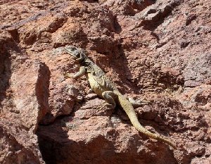
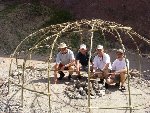
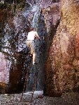
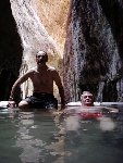
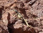
After ferrying across what had become a very swift river we arrived at Arizona Hot Springs just behind a couple of friendly downriver paddlers. They informed us that they were the lead party for a group of about 2 dozen that planned to stay at the springs and party for a few days. We decided we better enjoy the springs when we could. We followed a trail past the frame of a sweat lodge into a slot canyon that had warm water running down the bottom. A large chuckwalla lizard climbed up the canyon wall. If it was any larger we could have put a saddle on it. We were amazed that in such a popular canyon it had survived all of the scout groups. Eventually we climbed a ladder to find a series of pools that had been made with sand bags filled with the fine gravel from the bottom of the slot canyon. We enjoyed the company of some students on spring break from Bozeman Montana as we tested the varying temperatures of the pools. They were excited to know that you can still go on spring break 30 years later. The Bozeman group had hiked in from the highway above which is a very popular way to enjoy the hot springs.
Just as the river front was becoming a metropolis we jumped into our kayaks and headed upstream. We wondered how many Boy Scout groups and others would arrive by the end of the day. Our objective was to head upriver to a less popular place for the nights camp. We made it about ˝ mile when we ran into Ring Bolt Rapids, or more accurately it ran into us. The water was swift from one side of the river to the other and you could see the vertical rise in the river in front of you. We each tried our own technique to struggle past the obstacle and we all had the same result. After a valiant battle we ended up at various places downstream from the rapid. We regrouped and scouted the area for feasible portages. The portage option was marginal which led to the conclusion that we had found an excellent camping spot and with an early start in the morning we may be able to paddle the rapid. We met a Canadian couple that was camped near by and they told us the water was much lower in the morning so we were content that we had made the right decision. We hiked up the canyon that is used as the access to the warm springs from the highway above. One of us was captured by a bush with thorns that just seemed to reach out and grab you. Most things in the desert poke or bite. We met more Canadian couples in the canyon. The strong Canadian dollar and the warm temperatures had made this an irresistible escape from the frozen north. We were defiantly experiencing a southern migration and we were part of it. We enjoyed another relaxing evening in a broad canyon where we could enjoy the stars. Just after dark a helicopter squad flew overhead which is something we observed every night. We assumed they were tour helicopters returning from the Grand Canyon. We hiked back to the hot springs for a night time soak. Judging from the amount of candle wax on the cliffs around the pools this is a popular tradition. The night air was warm enough that a dip in the cold river water to wash off the minerals from the hot springs was even an inviting experience.
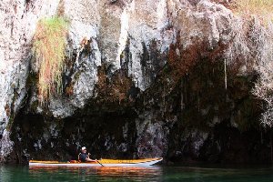
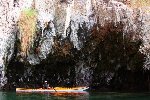
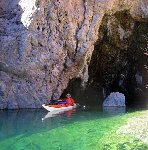
The next morning brought just a small decrease in the flow of the river and that was fading fast as the waterline moved up the bank. We had a fast breakfast and stormed the rapid in our kayaks. This time we tasted success but we all approached our endurance limit for sprint type paddling. Above the rapid the river remained swift but very manageable along the sides in the eddies. We paddled into a cave we had heard about just above the rapids. Unlike the rest of the trip it was much less than we had anticipated. We eventually found ourselves at the mouth of Boy Scout Canyon. We had it to ourselves and were tempted to explore it but the river was still rising and decided to continue to the dam.
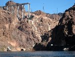
The only way to describe the paddle to the dam is it was difficult. The water was swift requiring strategic moves from side eddies to boulder eddies with a lot of work in between. We were approaching the dam as we were approaching exhaustion. We could see the bridge that is being constructed across the canyon clinging to the side of the cliff several hundred feet above us. An Osprey stood like a sentinel on the top of another cliff. And then like a bad joke homeland security had placed signs prohibiting up river travel less than 100 yards from where the river turns and you can see the dam. It made a convenient excuse to end the up river torture but made a very anticlimactic end also.
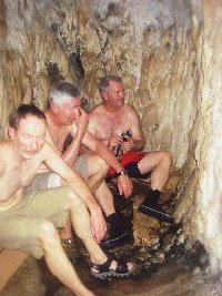
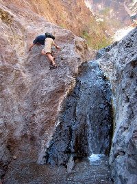
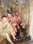
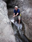
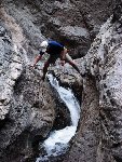
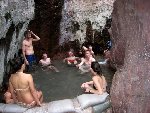
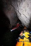
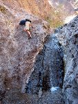
Just below our turnaround point was Sauna Cave. It is a man made cave and penetrates the side cliff for about 150 feet. It was guarded by a Boy Scout group from Phoenix equipped with aluminum canoes. Fortunately they were on their way out. A hot spring fills the bottom of the cave and steam fills the air. We found some planks to sit on in the back of the cave and steamed our brains for awhile in the 120 degree temperature. I rubbed my thumb across the fogged lens of a waterproof camera and managed to get some pictures. We bypassed the popular Nevada springs just below the Sauna Cave and paddled back to Boy Scout Canyon. Our friends from Phoenix had got there first and the leaders were fixing lunch as the scouts did what scouts do in the canyon. We met the bravest women we have ever met in the canyon; she was part of the scout group of over 25 boys and men. The canyon was a series of small climbs some having ropes for assistance. The water was extremely hot in the bottom. Hanging gardens and small waterfalls decorated the cliffs along the way. Scouts were running, jumping, swinging, and hanging everywhere enjoying the experience like only teenagers can. Four old men pushed, pulled, and snorted their way through the middle of it all. We eventually came to a cliff face several hundred feet high with a plunge pool below. This obstacle separated the men from the boys and we worked our way back down the canyon. Our kayaks that had been about 1 foot above the water were floating in about 1 foot of water when we returned. The day was warm enough that we took advantage of the shade from the trees at the mouth of the canyon and enjoyed a lunch. Another group came wandering out of the canyon. They had made the trip a few times before and willingly shared information with us. Between what they said and what a Canadian couple had told us earlier we decided that our next camp would be in Moon “something” canyon. None of us could remember if it was moonscape, moonshine, moon spring, or half moon, but it was moon something.
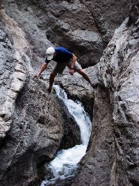
The water was extremely high when we approached Moonscape canyon. Using extra precaution we carried the boats well above the water line. We hiked up the broad canyon where a work crew had done a tremendous amount of work cutting out the invasive Tamarisk and planting willows. Some frogs played in the warm water that formed a stream in the bottom of the canyon. Eventually the trail led to a waterfall about 15 feet high with a pool at the bottom. The water was just comfortably warm and we lounged in it for a couple of hours. It was not common for any of us to take advantage of such luxury and leisure but with no where else to go we indulged and decompressed. It must have been effective because later that night only one of us remembered the first nights camp and all of our job pressures had drifted downstream. We enjoyed a dinner as we watched desert bighorn sheep work the cliffs on the opposite side of the river. We spent another night looking for satellites, and watching the stars. Sometime in the middle of the night I woke up laying where we had all been talking, everyone else had moved to their tents and their sleeping bags.
The next morning we were looking forward to a very rapid descent of Ring Bolt rapids and a swift paddle to Willow Beach. Instead we found the river several feet lower and the only movement was from the waves that were created by a 15mph up river wind. After a much longer and harder paddle than we had planned we arrived at Willow Beach. Several hours later we found ourselves driving through snow squalls as we drove along the Wasatch Front on the way home. Like the cookie twenty feet away, the reward was well worth the effort.
