The Trip Report: The plan
Roy is co-worker, he is a bit older than I, but one of those guys that is in really good physical shape. He runs 8km every day at lunch and walks or rides 3-4km to work. About a year ago Roy took an interest in buying a sea-kayak, and we discussed different things to look for. This summer he bought two, one for himself and one for the wife (lucky wife). It was only a matter of time before we got out together. It is not until the end of the season that he asks if I want to get together, and I do, it will be my first time out in the kayak this year.
The Plan was to meed at the Glenmore Reservoir, on Saturday, forecast is pretty good given it is late October, it looks like we may even get to the low double digits. The forecast does mention something about wind gusts up to 40km/hr in the late afternoon. Roy, his wife and I will spend a few hours out on the reservoir, paddling up to where the Elbow river flows in, an area known as weasel head flats.
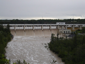
Glenmore reservoir is the water reservoir in side the city of Calgary. It is nice in that there are no motor boats allowed on the water (other than the rescue boat). Considering the lake is in the city, there is not much intrusion of the city itself (except the Dam and the big hwy running over the north side of the lake). It is small, but nice. The best part is the North West side, which is our route for the day, is a park, and devoid of building. The North side is a dam, and prior to that is the bridge by which Glenmore trail (Hwy) runs over the lake. The north side of the shore is less appealing. The West side, where the Elbow river runs into the reservoir is known as Weasel Head flats. This is still part of the park, and trails run down and through it from the higher banks to the north. It is paddling though here that is most attractive, although there are people around, it is a nice destination as it feels on the verge of being wild. And it is somewhat as just west of here are first nations land, which has not been swallowed by the city yet.
Meeting Roy and Sandra:
We only need to delay the time of the planned meet up by an 1/2 an hour to 11:30 in order to make it work. As I'm pulling in to the parking lot at the Calgary Canoe club, I see Sandra (Roy's wife) walking away from the parking lot. Roy tells me she if off to find the little girls room. Roy and I unpack our stuff, and use his kayak cart to get the kayaks down to the lake. We complete our little portage in a leisurely pace, still no Sandra... Roy gets in the car and goes looking for her. It turns out the facilities are pretty far away, and there was no cause for worry, not that we were. (There are bathrooms at the canoe club, but today they were locked. Oh and you can rent canoes there, but that was closed too, I guess it is too late in the season).
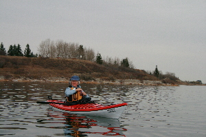
I decide to launch from the dock, it is the floating variety, so the kayak deck floats about the same height as the top of the deck. So you'd think it would be about as easy as launching from a dock could get. However it is my first time out kayaking this year... It just feels wrong, I decide to launch from shore. I'm not wearing a wet suit. There is no point in falling in at the start, not when it is 10 Deg C out, and the water going to be more or less 0 Deg C.
Paddle out:
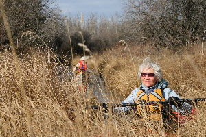
Sandra, some final adjustments
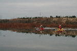
We head out from the docks at the Calgary Canoe club (these are public docs by the way, open to all, at least until end of October). We travel south away from the sounds of the Glenmore Trail then around the bend to the West. As we travel west the 'cliffs' to the north do not provide for much of a view, at least not for us. There are a few park goers out today which we see from time to time, and as always one or two fishermen on the shore.
The water is deeper than any other time I have paddled it. The must be filling the reservoir for the winter. Places that were a few inches deep (shown as dots on the map) are now under 3 or 4 ft of water. We are heading for Weasel head flats, which is the point of the reservoir that has filled in with sediment over the years, making for a nice delta. this has become a bird sanctuary like area. There are several beaver lodges here, lots of willows and scrub as the river meanders in to the lake.
Getting left behind
On the way out, I try to race ahead to get a picture or two of Roy and Sandra paddling towards me, unfortunately as I get my camera out I knock the pelican case into the lake. The foam is not closed cell foam, which is to say it is like a giant sponge. So now I'm keeping my camera under the deck skirt to give it some protection from the water. That's okay, just means fewer pics, as it is bother some getting it out. By the time I get the case emptied, and the sponge inserts squeezed out, deck on, and going again, Roy and Sandra are well ahead and just entering the Weasel head area.
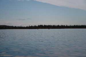
Nice calm day... no wind yet
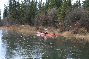
Roy and Sandra checking out the willows _or maybe looking for the channel?_
I catch up, as Roy and Sandra are in amongst the willows. Normally they are a few feet above the water line, but now you can paddle right through them. Roy and Sandra are moving along the 'shore' looking for the main channel. I catch them right at the head of the channel. At normal levels there is a little current at the the main channel, not so much though as it has widened and deepened compared to the Elbow River. Today there is no noticable current. The channel runs from the center/left side of the delta, and arcs around to the right. The river-right bank being about 6-8 feet high.
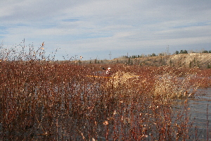
June 2005 Flood picture
There has obviously been a flood, as there are a several large old dead trees in the flats. This was likely the flood in June of 2005 (or was it 6?). During this flood the Dam was overwhelmed. There was something like 200cms of water flow through the elbow river in town. Normal flow is 12-20cms. Today it is at the lower end of that, but the water is deeper than normal as the river is backed up by the lake.
The Channel turns back to the left, and the current picks up a bit.. but not so much today as normal. We easily make it to the walking bridge at the point where the river is normally a river. Today it is still in the backed up water level. There is water flowing but not much.
Water is Nice and cool, and crunchy.
We take a detour. There is a small walking bridge that crossed a creek that flows into the river. It is just after the main walking bridge that crosses the river proper. Roy tells me that you can not go far up it as it is normally to shallow and narrow. However today we are able to move up several hundred meters. The channel has little or no flow, and is a dozen or so feet wide. Sandra is in the lead (which was typical for this trip). Soon there was an odd crunching sound coming from the water that was very still. It took a second or two to realize that she was now playing ice breaker.
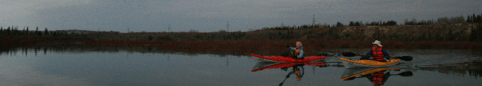
Sandra has a new carbon fiber paddle, we push through for a while but the ice is getting thicker. Sandra wants to turn back, and we do so. She tells me later that she did not want to damage the paddle. There is a fairly active walking path through the area, several times we share waves with people, and have our photos taken as we paddle.
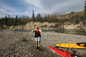
Stopping for lunch
Back on the Elbow river, we able to paddle to what was my previous record for upstream travel, where in the past the combination of current and lack of river depth prevented me from going further. This point is about 50 past the bridge. Today it is easy going to go further, several hundred meters before the current in one channel becomes to much, or the route to shallow in the other. We stop for lunch.
Just up stream from where we stop, there is a channel that looks a lot like the one we stopped going up (no channels shown on the map, not sure why?). We debate caring the boats up stream a bit and going down the channel, but opt not to. We 'run the rapids' back. which is to say enjoy the lazy float back with the current. However we decide to take another crack at the side channel to see if it meets up.
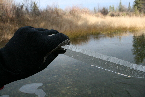
It was a bit thicker than this in places, but not much.
We follow the side channel again. The areas where previously we broke through ice are now clear. However we are soon crunching our way forward through ice a bit further up stream. It starts out thin and thickened as we went along. Ice less than 1/8ths inch thick is hardly noticed. As it approaches 1/4 inch thick, it starts to make turning difficult. I act as lead Ice breaker. I enjoy the sensation of crunching through the ice. As the ice gets to 1/2 an inch thick you actually have to concentrate on breaking the paddle through it, or it just deflects and then skims on the surface. Turning is quite difficult.
Paddling through the grass and ice... we are definately not in BC on the ocean.
The ice does not get thicker, in fact in places it clears out again. We come to a very narrow bit where the canoes can barely fit both for depth and width. then it widens up again. it looks promising that we will be back to our lunch spot soon. However a 100m or so up the channel narrows, and chokes out with grass. We are low enough that we can not see forward. It looks like it may clear ahead, but getting to walk over and take a look, out shows we truly are at a dead end.
In the narrow channel which is full of ice, I need to back up quite away before I can turn around. Then it is back through the narrow channel we cut earlier through the ice. By moving a few feet to the side, I get to play Icebreaker again just for fun. At some point I wonder how the wood boat is holding up. (later shows quite well)
A very nice trip, but our adventure was not over yet. after we pass the foot bridge, we take a channel that is not normally open, which is interesting. Several beaver lodges on it. This converges with the main channel, but we again diverge from it and paddle directly through the willows.
Roy coming through the willows.
As we come out of the delta we have a considerable wind at our back (Roy later tells me it was posted as 70km an hour). A distance of 50m from the trees is enough to be in waves a ft high. It is 500m or so back to the bend in the shore where we turn to get to the canoe club. We 'surf' back, the odd splash in the back reminds me that I really don't want to fall in. The waves, wind and direction of travel are such that I Really have to work to stay on course, remind me I really need to put a rudder on.
Once around the point we are in the shelter, and an short easy paddle on flat water back to the dock. That's it for the kayaking season for me, sadly my only trip out this summer (the canoe got a bit of use though).
|